|
search place name
|
||
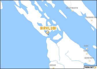
Airklubi (Indonesia)Airklubi is a town in Indonesia. An overview map of the region around Airklubi is displayed below.
regional and 3d topo map of Airklubi, Indonesia ::
Airklubi airports ::
The nearest airport is SIN - Singapore Changi Intl, located 157.8 km north of Airklubi.
Other airports nearby include QPG - Paya Lebar (162.5 km north west), XSP - Singapore Seletar (170.1 km north west), JHB - Johor Bahru Sultan Ismail (202.0 km north west), DJB - Jambi Sultan Thaha (206.3 km south west), Nearby towns ::
[all distances 'as the bird flies' and approximate] 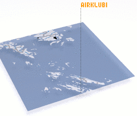 Places with similar names to Airklubi, Indonesia ::
// Argolibio (ES)
Disclaimer :: Information on this page comes without warranty of any kind |
||
|
Where is Airklubi? Elevation and coordinates ::
Latitude (lat): 0°1'0"S Longitude (lon): 104°30'0"E
Elevation (approx.): -32768m (map arrows pan, magnifying glasses zoom) |
||
|
Visiting Airklubi? Hotel/Accommodation ::
Book a hotel in Airklubi Travel Guide ::
Buy a travel guide for Indonesia rental cars ::
car rental offers GPS waypoint ::
download a GPX waypoint (PoI) of Airklubi for your GPS receiver
|
||