|
search place name
|
||
Artafeia (Maluku, Indonesia)Artafeia is a town in the Maluku region of Indonesia. An overview map of the region around Artafeia is displayed below.
regional and 3d topo map of Artafeia, Indonesia ::

Artafeia airports ::
The nearest airport is FKQ - Fak Fak, located 179.0 km north east of Artafeia.
Nearby towns ::
Angar (0.9km north) //
Kianlaut (2.1km south east) //
Kilwo (2.8km north) //
Kilaba (3.3km north east) //
Aruan (3.3km south east) //
Kiandarat (3.8km west) //
Kilgah (4.1km north east) //
Selagor (4.6km south west) //
Selagor Kota (5.0km south) //
Amanau (6.5km south) //
Walang Tengah (6.7km north) //
Nama (6.7km south) //
Kilesir (8.5km north east) //
Danama (10.0km north east) //
[all distances 'as the bird flies' and approximate] 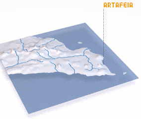 Places with similar names to Artafeia, Indonesia ::
// Ardaf (CM)
// Ārdava (LV)
// Ardeova (RO)
// Artova (TR)
// Ar Rudayyif (TN)
// Artavia (ES)
// Arituava (MX)
// Ar Radifah (SA)
// Ar Ridīfah (SA)
// Ar Ruḑayfah (SY)
Disclaimer :: Information on this page comes without warranty of any kind |
||
|
Where is Artafeia? Elevation and coordinates ::
Latitude (lat): 3°39'30"S Longitude (lon): 130°50'0"E
Elevation (approx.): -32768m (map arrows pan, magnifying glasses zoom) |
||
|
Visiting Artafeia? Hotel/Accommodation ::
Book a hotel in Artafeia Travel Guide ::
Buy a travel guide for Indonesia rental cars ::
car rental offers GPS waypoint ::
download a GPX waypoint (PoI) of Artafeia for your GPS receiver
|
||