|
search place name
|
||
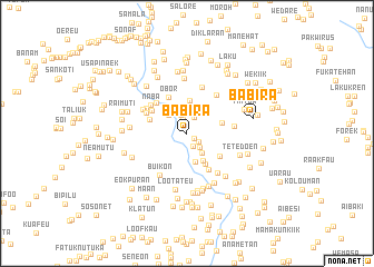
Babira (Nusa Tenggara Timur, Indonesia)Babira is a town in the Nusa Tenggara Timur region of Indonesia. An overview map of the region around Babira is displayed below.
regional and 3d topo map of Babira, Indonesia ::
Babira airports ::
The nearest airport is DIL - Dili Presidente Nicolau Lobato Intl, located 116.6 km north east of Babira.
Nearby towns ::
Tatook (0.9km south east) //
Aiputu (1.4km north) //
Buitae (1.4km south east) //
Taisuni (1.5km south east) //
Abatbuti (1.8km north east) //
Pelita (1.9km south east) //
Fatuklobo (2.0km north) //
Nusakar (2.0km north) //
Nunsakar (2.2km north) //
Talimetan (2.5km south east) //
Selora (2.6km north west) //
Tuaninu (2.9km south) //
Tuaniu (3.1km south east) //
Motasokon (3.3km north) //
Pasi (3.6km south east) //
Bekataruik (3.6km east) //
Fatubibi (3.9km west) //
Butero (4.0km south east) //
Obor (4.1km north west) //
Oenereu B (4.1km north west) //
Sitrua (4.2km south east) //
Kelatun (4.4km north west) //
Oenereu A (4.5km north west) //
Naba (4.5km north west) //
Aubulak (4.7km north west) //
Abatwain (4.7km east) //
Fatubesi (4.8km north east) //
Wenanan (4.9km north) //
Oeklese (4.9km north west) //
[all distances 'as the bird flies' and approximate] 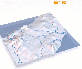 Places with similar names to Babira, Indonesia ::
Disclaimer :: Information on this page comes without warranty of any kind |
||
|
Where is Babira? Elevation and coordinates ::
Latitude (lat): 9°22'38"S Longitude (lon): 124°52'17"E
Elevation (approx.): 270m (map arrows pan, magnifying glasses zoom) |
||
|
Visiting Babira? Hotel/Accommodation ::
Book a hotel in Babira Travel Guide ::
Buy a travel guide for Indonesia rental cars ::
car rental offers GPS waypoint ::
download a GPX waypoint (PoI) of Babira for your GPS receiver
|
||