|
search place name
|
||
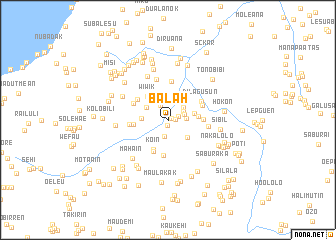
Balah (Nusa Tenggara Timur, Indonesia)Balah is a town in the Nusa Tenggara Timur region of Indonesia. An overview map of the region around Balah is displayed below.
regional and 3d topo map of Balah, Indonesia ::
Balah airports ::
The nearest airport is DIL - Dili Presidente Nicolau Lobato Intl, located 70.1 km north east of Balah.
Nearby towns ::
Nuaderok (0.5km north east) //
Lakmau (0.6km south) //
Wesuer (0.8km east) //
Haekesak (1.2km east) //
Beremanu (1.8km north west) //
Fatubelou (1.9km south) //
Wekrame (1.9km east) //
Sakafini (2.0km north east) //
Nitaskotun (2.1km east) //
Kotafoun (2.2km north east) //
Falohai (2.7km north west) //
Kotakfau (2.9km south east) //
Besakren (2.9km west) //
Derok (3.0km east) //
Fohomeak (3.3km east) //
Wiwik (3.5km north west) //
Koin (3.6km south west) //
Nuren (3.8km south west) //
Boasuin (3.9km east) //
Nuren (3.9km west) //
Ninluli (4.1km south) //
Ferikatuas (4.1km north west) //
Lisuaben (4.1km north east) //
Mohak (4.2km north west) //
Dilagusun (4.2km north east) //
Maulelo (4.3km north) //
Remian (4.3km west) //
Maululin (4.5km east) //
Ualeten (4.6km north) //
[all distances 'as the bird flies' and approximate] 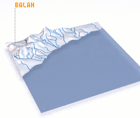 Places with similar names to Balah, Indonesia ::
Disclaimer :: Information on this page comes without warranty of any kind |
||
|
Where is Balah? Elevation and coordinates ::
Latitude (lat): 9°0'54"S Longitude (lon): 125°5'46"E
Elevation (approx.): 251m (map arrows pan, magnifying glasses zoom) |
||
|
Visiting Balah? Hotel/Accommodation ::
Book a hotel in Balah Travel Guide ::
Buy a travel guide for Indonesia rental cars ::
car rental offers GPS waypoint ::
download a GPX waypoint (PoI) of Balah for your GPS receiver
|
||