|
search place name
|
||
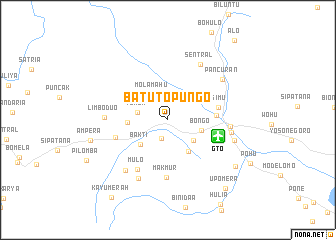
Batutopungo (Sulawesi Utara, Indonesia)Batutopungo is a town in the Sulawesi Utara region of Indonesia. An overview map of the region around Batutopungo is displayed below.
regional and 3d topo map of Batutopungo, Indonesia ::
Batutopungo airports ::
The nearest airport is GTO - Gorontalo Jalaluddin, located 5.9 km east of Batutopungo.
Other airports nearby include LUW - Luwuk Bubung (187.2 km south), Nearby towns ::
Diata (2.2km south) //
Molamahu (3.4km north west) //
Tumba (3.5km west) //
Olumongo (3.6km south east) //
Bongo (3.9km east) //
Bakti (4.2km south west) //
Uluhu (4.2km south east) //
Hulawalu (4.5km west) //
Datahu (5.5km east) //
Isimu (5.8km east) //
Buhiya (6.0km east) //
Jalanraya (6.2km west) //
Makmur (6.4km south) //
Mulo (6.5km south west) //
Satria (7.0km east) //
Limboduo (7.1km west) //
Isimu (7.2km east) //
Sentral (7.2km north east) //
Rombongan (7.3km south west) //
Batulayar (7.4km south west) //
Pancuran (7.6km north east) //
Bongomeme (7.8km east) //
Ampera (8.9km west) //
Bontula (9.1km south east) //
Upomera (10.0km south east) //
Kayumerah (10.7km south west) //
Alo (11.6km north east) //
[all distances 'as the bird flies' and approximate] 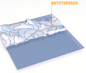 Places with similar names to Batutopungo, Indonesia :: Disclaimer :: Information on this page comes without warranty of any kind |
||
|
Where is Batutopungo? Elevation and coordinates ::
Latitude (lat): 0°39'14"S Longitude (lon): 122°47'58"E
Elevation (approx.): 56m (map arrows pan, magnifying glasses zoom) |
||
|
Visiting Batutopungo? Hotel/Accommodation ::
Book a hotel in Batutopungo Travel Guide ::
Buy a travel guide for Indonesia rental cars ::
car rental offers GPS waypoint ::
download a GPX waypoint (PoI) of Batutopungo for your GPS receiver
|
||