|
search place name
|
||
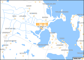
Betoyo (Jawa Timur, Indonesia)Betoyo is a town in the Jawa Timur region of Indonesia. An overview map of the region around Betoyo is displayed below.
regional and 3d topo map of Betoyo, Indonesia ::
Nearby towns ::
Betoyoguci (0.6km north east) //
Sembayat (3.8km north east) //
Karangrejo (4.3km north east) //
Bungah (4.8km north) //
Manyar (5.4km south east) //
Manyarrejo (5.7km south east) //
Tenger (6.1km south east) //
Metirang (7.2km north west) //
Suci (7.3km south east) //
Sukomulio (7.4km south east) //
Ambengambeng (7.7km south) //
Yosowilangun (8.6km south east) //
Singopadu (8.8km south east) //
Glagah (9.8km north west) //
Lonjong (9.8km north west) //
Maduran (10.3km south east) //
Karangbinangun (10.5km north west) //
Mengare (10.5km north east) //
Giri (11.1km south east) //
Kebomas (11.3km south east) //
[all distances 'as the bird flies' and approximate]  Places with similar names to Betoyo, Indonesia ::
Disclaimer :: Information on this page comes without warranty of any kind |
||
|
Where is Betoyo? Elevation and coordinates ::
Latitude (lat): 7°5'45"S Longitude (lon): 112°33'34"E
Elevation (approx.): 6m (map arrows pan, magnifying glasses zoom) |
||
|
Visiting Betoyo? Hotel/Accommodation ::
Book a hotel in Betoyo Travel Guide ::
Buy a travel guide for Indonesia rental cars ::
car rental offers GPS waypoint ::
download a GPX waypoint (PoI) of Betoyo for your GPS receiver
|
||