|
search place name
|
||
Brongosan (Indonesia)Brongosan is a town in Indonesia. An overview map of the region around Brongosan is displayed below.
regional and 3d topo map of Brongosan, Indonesia ::
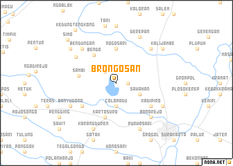
Nearby towns ::
Manggung (1.8km east) //
Buluh (2.6km north west) //
Colomadu (3.7km south) //
Sawahan (4.1km south east) //
Nogosari (5.6km north) //
Bendo (5.8km north west) //
Kartosuro (5.9km south) //
Sambi (6.2km west) //
Ngemplak (6.6km south west) //
Kadipiro (6.6km south east) //
Bangak (6.6km south west) //
Babadan (7.7km north west) //
Bendungan (7.8km north west) //
Bonorejo (7.8km south east) //
Kalioso (7.8km north east) //
Lawean (8.3km south east) //
Derepan (8.3km north east) //
Karangduren (8.3km south west) //
Purwosari (8.3km south east) //
Banyudono (8.2km south west) //
Kadiporo (8.2km south east) //
Kalijambe (9.2km north east) //
Temon (9.2km north west) //
Simo (10.5km north west) //
Kedungtengkong (10.8km north west) //
[all distances 'as the bird flies' and approximate] 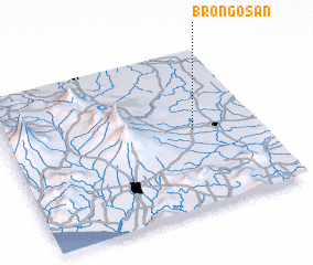 Places with similar names to Brongosan, Indonesia ::
Disclaimer :: Information on this page comes without warranty of any kind |
||
|
Where is Brongosan? Elevation and coordinates ::
Latitude (lat): 7°30'0"S Longitude (lon): 110°45'0"E
Elevation (approx.): 122m (map arrows pan, magnifying glasses zoom) |
||
|
Visiting Brongosan? Hotel/Accommodation ::
Book a hotel in Brongosan Travel Guide ::
Buy a travel guide for Indonesia rental cars ::
car rental offers GPS waypoint ::
download a GPX waypoint (PoI) of Brongosan for your GPS receiver
|
||