|
search place name
|
||
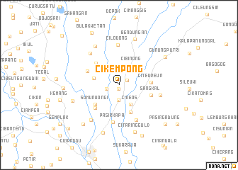
Cikempong (Indonesia)Cikempong is a town in Indonesia. An overview map of the region around Cikempong is displayed below.
regional and 3d topo map of Cikempong, Indonesia ::
Cikempong airports ::
The nearest airport is CGK - Jakarta Soekarno Hatta Intl, located 45.3 km north west of Cikempong.
Nearby towns ::
Kambing (0.6km south) //
Kandangsapi Tiga (1.5km north east) //
Nangewer (2.0km west) //
Babakan Cikeas (2.4km south) //
Cikeas (3.6km south east) //
Cibinong (3.7km north east) //
Sawah (4.0km west) //
Sentul (4.6km south east) //
Sumurwangi (4.8km south west) //
Pabuaran (5.0km north west) //
Citeureup (5.0km east) //
Cilebut (5.2km south west) //
Sangkal (5.4km east) //
Susukan (5.4km north west) //
Pasirkapa (6.0km south) //
Kedungmanggu (6.2km south east) //
Cilodong (6.3km north) //
Dukuh 1 (6.6km east) //
Citayam 2 (6.7km north west) //
Babakan 5 (7.0km south west) //
Kampungli (7.1km north west) //
Bendungan (7.6km north) //
Lamping (7.7km west) //
Citaringgul 1 (7.9km south) //
Kalibata 1 (7.9km south) //
Kedunghalang (8.3km south west) //
Gunungputri (8.5km north east) //
Bojonggede 1 (8.7km west) //
Babakan Madang (8.8km south east) //
[all distances 'as the bird flies' and approximate] 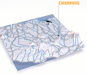 Places with similar names to Cikempong, Indonesia ::
// Secampanac (GT)
// Sekampung (ID)
Disclaimer :: Information on this page comes without warranty of any kind |
||
|
Where is Cikempong? Elevation and coordinates ::
Latitude (lat): 6°29'41"S Longitude (lon): 106°50'2"E
Elevation (approx.): 139m (map arrows pan, magnifying glasses zoom) |
||
|
Visiting Cikempong? Hotel/Accommodation ::
Book a hotel in Cikempong Travel Guide ::
Buy a travel guide for Indonesia rental cars ::
car rental offers GPS waypoint ::
download a GPX waypoint (PoI) of Cikempong for your GPS receiver
|
||