|
search place name
|
||
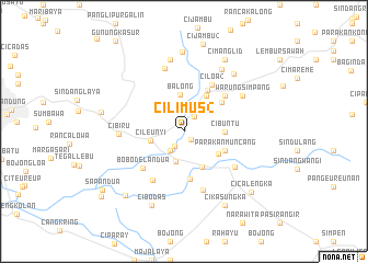
Cilimus 2 (Indonesia)Cilimus 2 is a town in Indonesia. An overview map of the region around Cilimus 2 is displayed below.
regional and 3d topo map of Cilimus 2, Indonesia ::
Cilimus 2 airports ::
The nearest airport is CGK - Jakarta Soekarno Hatta Intl, located 153.0 km north west of Cilimus 2.
Nearby towns ::
Jatiroke (1.1km south east) //
Sayang (1.8km south west) //
Cikeruh (1.8km north east) //
Bojongloa (2.4km south west) //
Rancaekek (3.2km south) //
Cileunyi (3.5km west) //
Balong (3.8km north) //
Warungcina (4.0km south east) //
Cibuntu (4.1km east) //
Ciparla (4.2km south east) //
Citali (4.3km north east) //
Parakanmuncang (4.6km south east) //
Tanjungsari (4.8km north east) //
Kaniungsari (4.8km north east) //
Jambu (4.9km south) //
Lebakjati (5.5km north east) //
Ciloa 2 (5.5km north east) //
Bobodelan Dua (5.6km south west) //
Rancabatuk Dua (5.9km south west) //
Cabok 2 (6.3km south) //
Tarikolot-kaler (6.2km south east) //
Cibiru (6.6km west) //
Genteng (6.8km north) //
Warungsimpang (7.0km north east) //
Seloe (7.4km north east) //
Ciwangun (7.4km north) //
Cimasuk (7.7km north east) //
Pasirkahki (8.1km north) //
Cibodas (8.2km south west) //
[all distances 'as the bird flies' and approximate] 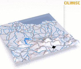
Disclaimer :: Information on this page comes without warranty of any kind |
||
|
Where is Cilimus 2? Elevation and coordinates ::
Latitude (lat): 6°55'57"S Longitude (lon): 107°46'45"E
Elevation (approx.): 709m (map arrows pan, magnifying glasses zoom) |
||
|
Visiting Cilimus 2? Hotel/Accommodation ::
Book a hotel in Cilimus 2 Travel Guide ::
Buy a travel guide for Indonesia rental cars ::
car rental offers GPS waypoint ::
download a GPX waypoint (PoI) of Cilimus 2 for your GPS receiver
|
||