|
search place name
|
||
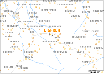
Cisarua (Indonesia)Cisarua is a town in Indonesia. An overview map of the region around Cisarua is displayed below.
regional and 3d topo map of Cisarua, Indonesia ::
Cisarua airports ::
The nearest airport is CGK - Jakarta Soekarno Hatta Intl, located 65.4 km north west of Cisarua.
Nearby towns ::
Cipayung (1.4km north west) //
Ciguntur (1.5km north east) //
Cilember Udik 1 (2.2km east) //
Kopo 2 (2.5km south east) //
Pasirmuncang 1 (2.7km south) //
Cilama (2.7km south) //
Pondok Cipaseban (3.0km east) //
Megamendung (3.2km north) //
Situ 2 (3.7km south) //
Brujul (3.7km south east) //
Gadok 1 (4.2km west) //
Gununggeulis (5.4km north west) //
Tagalbato (5.5km south east) //
Pasirkuda (5.6km north west) //
Cipaok (5.7km south west) //
Tapos (6.3km south west) //
Paragajen (6.4km south east) //
Sampal 2 (6.6km south east) //
Ciawi 3 (6.8km west) //
Pasirpanjang (6.9km south east) //
Cibotang (6.9km south west) //
Ciawi (7.0km west) //
Telukpinang (7.1km west) //
Ciherangsating (7.6km south west) //
Campaka (7.9km south east) //
Caringin 2 (8.0km south west) //
Leuwigoong (8.6km north) //
Cimandala (8.6km north) //
Tanjakanranji (8.6km west) //
[all distances 'as the bird flies' and approximate]  Places with similar names to Cisarua, Indonesia ::
Disclaimer :: Information on this page comes without warranty of any kind |
||
|
Where is Cisarua? Elevation and coordinates ::
Latitude (lat): 6°39'37"S Longitude (lon): 106°54'28"E
Elevation (approx.): 651m (map arrows pan, magnifying glasses zoom) |
||
|
Visiting Cisarua? Hotel/Accommodation ::
Book a hotel in Cisarua Travel Guide ::
Buy a travel guide for Indonesia rental cars ::
car rental offers GPS waypoint ::
download a GPX waypoint (PoI) of Cisarua for your GPS receiver
|
||