|
search place name
|
||
Gegarbentang (Indonesia)Gegarbentang is a town in Indonesia. An overview map of the region around Gegarbentang is displayed below.
regional and 3d topo map of Gegarbentang, Indonesia ::

Gegarbentang airports ::
The nearest airport is CGK - Jakarta Soekarno Hatta Intl, located 76.2 km north west of Gegarbentang.
Nearby towns ::
Ciloto (1.7km north east) //
Gegarbensang (2.6km east) //
Tengahgirang (2.9km north) //
Puncak (3.0km north west) //
Cimacan (3.2km north east) //
Cibodas (3.8km south east) //
Campaka (4.1km north west) //
Ciseureuh (4.3km north east) //
Cipanas (4.6km east) //
Cinengangirang (4.7km north east) //
Barukupa (4.9km east) //
Paragajen (5.5km north west) //
Sampal 2 (5.5km north west) //
Sindanglaya (5.5km east) //
Pasakon 1 (5.8km east) //
Tagalbato (6.4km north west) //
Pacet (6.4km east) //
Pasirpanjang (6.4km west) //
Malabar (6.6km south east) //
Cibodas (6.6km east) //
Telagawarna (6.8km north) //
Cibadak (7.5km east) //
Heregam 1 (7.9km south east) //
Panjaweujan (7.9km south east) //
Cikundul (7.9km east) //
Brujul (8.2km north west) //
Cikujang (8.3km north east) //
Ciwalen (8.5km east) //
Nyalindung (8.9km south east) //
[all distances 'as the bird flies' and approximate] 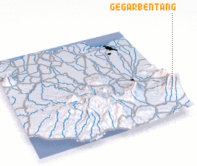 Places with similar names to Gegarbentang, Indonesia :: Disclaimer :: Information on this page comes without warranty of any kind |
||
|
Where is Gegarbentang? Elevation and coordinates ::
Latitude (lat): 6°43'42"S Longitude (lon): 106°59'25"E
Elevation (approx.): 1647m (map arrows pan, magnifying glasses zoom) |
||
|
Visiting Gegarbentang? Hotel/Accommodation ::
Book a hotel in Gegarbentang Travel Guide ::
Buy a travel guide for Indonesia rental cars ::
car rental offers GPS waypoint ::
download a GPX waypoint (PoI) of Gegarbentang for your GPS receiver
|
||