|
search place name
|
||
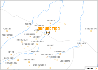
Gunungtiga (Lampung, Indonesia)Gunungtiga is a town in the Lampung region of Indonesia. An overview map of the region around Gunungtiga is displayed below.
regional and 3d topo map of Gunungtiga, Indonesia ::
Gunungtiga airports ::
The nearest airport is CGK - Jakarta Soekarno Hatta Intl, located 180.1 km south east of Gunungtiga.
Nearby towns ::
Gedongdalem (1.5km west) //
Bumijawa Baru 2 (3.0km north east) //
Jojok (4.6km west) //
Tamansari (4.6km north) //
Ramanhaji (4.7km north west) //
Munung (4.9km south) //
Siraman (5.1km west) //
Gondangrejo (5.7km south west) //
Ramanutara (6.3km north east) //
Gantiwarno (7.3km west) //
Tamanbogo (7.5km north east) //
Sumbersari (8.3km south east) //
Sumbargede (8.3km south) //
Buring (8.6km north west) //
Selorejo (8.8km south west) //
Pekalongan (9.0km south west) //
[all distances 'as the bird flies' and approximate] 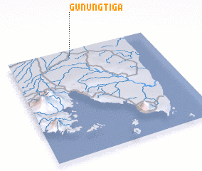 Places with similar names to Gunungtiga, Indonesia ::
// Guininguédougou (BF)
// Kaninkadaik (MM)
Disclaimer :: Information on this page comes without warranty of any kind |
||
|
Where is Gunungtiga? Elevation and coordinates ::
Latitude (lat): 5°2'47"S Longitude (lon): 105°26'17"E
Elevation (approx.): 47m (map arrows pan, magnifying glasses zoom) |
||
|
Visiting Gunungtiga? Hotel/Accommodation ::
Book a hotel in Gunungtiga Travel Guide ::
Buy a travel guide for Indonesia rental cars ::
car rental offers GPS waypoint ::
download a GPX waypoint (PoI) of Gunungtiga for your GPS receiver
|
||