|
search place name
|
||
Gusung (Sulawesi Selatan, Indonesia)Gusung is a town in the Sulawesi Selatan region of Indonesia. An overview map of the region around Gusung is displayed below.
regional and 3d topo map of Gusung, Indonesia ::

Gusung airports ::
The nearest airport is UPG - Ujung Pandang Hasanuddin, located 16.4 km east of Gusung.
Nearby towns ::
Cambalompo (0.9km north east) //
Butung (1.3km south) //
Cambacaddi (1.5km north east) //
Makassar (1.7km south) //
Wajo (2.1km south east) //
Kulukuang (2.6km east) //
Agampencara (2.8km north east) //
Pattingaloang (2.9km north east) //
Pampang (3.4km south east) //
Ujungparappak (4.5km north east) //
Mariso (5.0km south) //
Panaikang (5.4km south east) //
Tarallawe (5.8km east) //
Pacinongong (5.8km east) //
Mamajangdalam (6.2km south east) //
Sambungjawa (6.2km south east) //
Parangloe (6.4km east) //
Lantebung (7.1km north east) //
Balang Baru (7.3km south) //
Balangberu (7.5km south) //
Pannara (7.5km south east) //
Katangka (7.7km south) //
Pagandongan (8.1km north east) //
Telo (8.1km south east) //
Jongaya (8.4km south west) //
Pamalungan (9.0km east) //
Biringromang (9.8km south east) //
Sungguminasa (10.0km south east) //
Romanggaya (10.6km south east) //
[all distances 'as the bird flies' and approximate] 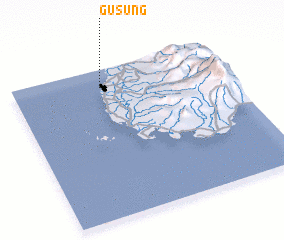 Places with similar names to Gusung, Indonesia ::
Disclaimer :: Information on this page comes without warranty of any kind |
||
|
Where is Gusung? Elevation and coordinates ::
Latitude (lat): 5°6'58"S Longitude (lon): 119°25'1"E
Elevation (approx.): 7m (map arrows pan, magnifying glasses zoom) |
||
|
Visiting Gusung? Hotel/Accommodation ::
Book a hotel in Gusung Travel Guide ::
Buy a travel guide for Indonesia rental cars ::
car rental offers GPS waypoint ::
download a GPX waypoint (PoI) of Gusung for your GPS receiver
|
||