|
search place name
|
||
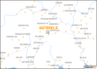
Hutamela (Sulawesi Utara, Indonesia)Hutamela is a town in the Sulawesi Utara region of Indonesia. An overview map of the region around Hutamela is displayed below.
regional and 3d topo map of Hutamela, Indonesia ::
Hutamela airports ::
The nearest airport is GTO - Gorontalo Jalaluddin, located 37.7 km east of Hutamela.
Other airports nearby include LUW - Luwuk Bubung (186.1 km south), Nearby towns ::
Moronjoe (2.6km east) //
Cendrawasih (3.4km west) //
Wonggahu (3.6km north east) //
Mekarjaya (3.8km north west) //
Siliwangi (3.8km south west) //
Tanjungharapan (5.0km north) //
Kotaraja (5.7km south west) //
Mutiara (6.7km north east) //
Molobulahe (6.7km east) //
Ohulingo (7.3km north) //
Abadi (7.8km north) //
Pariya (8.0km south west) //
Bongo (8.6km north) //
Mulya (10.1km north west) //
Pulubaala (10.2km south west) //
Gunungsari (11.8km north east) //
[all distances 'as the bird flies' and approximate] 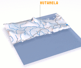 Places with similar names to Hutamela, Indonesia ::
// Haidemühl (DE)
// Haid am Bühl (DE)
// Haidmühl (DE)
// Heidmühle (DE)
// Heidmühle (DE)
// Hadımlı (TR)
// Hota-Mbeule (ZA)
// Hoda Mela (ET)
// White Mill (US)
// Whitmell (US)
Disclaimer :: Information on this page comes without warranty of any kind |
||
|
Where is Hutamela? Elevation and coordinates ::
Latitude (lat): 0°37'26"S Longitude (lon): 122°30'42"E
Elevation (approx.): 101m (map arrows pan, magnifying glasses zoom) |
||
|
Visiting Hutamela? Hotel/Accommodation ::
Book a hotel in Hutamela Travel Guide ::
Buy a travel guide for Indonesia rental cars ::
car rental offers GPS waypoint ::
download a GPX waypoint (PoI) of Hutamela for your GPS receiver
|
||