|
search place name
|
||
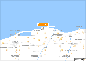
Janka (Aceh, Indonesia)Janka is a town in the Aceh region of Indonesia. An overview map of the region around Janka is displayed below.
regional and 3d topo map of Janka, Indonesia ::
Janka airports ::
The nearest airport is BTJ - Banda Aceh Sultan Iskandarmuda, located 156.6 km west of Janka.
Other airports nearby include MES - Medan Polonia (279.7 km south east), Nearby towns ::
Buga (1.5km south east) //
Aluebie (2.6km south west) //
Jaromahbaroh (3.2km south east) //
Panteara (4.6km south) //
Kulu (5.0km south) //
Pulo (5.2km south west) //
Tingkeum (5.4km south east) //
Kruengpanjo (5.9km south) //
Monklayu (6.6km east) //
Matangglumpangdua (7.0km south) //
Linggong (7.1km south west) //
Lapang-barat (7.1km south east) //
Mangang (7.2km south east) //
Cotbada-barat (8.1km south west) //
Kubu (8.6km south) //
Geurugok (8.6km south east) //
Cotpuuk (8.8km east) //
Cotgirek (9.0km south west) //
Blangrambong (9.9km south west) //
Leubumasid (10.0km south east) //
Lapehan (11.9km south east) //
[all distances 'as the bird flies' and approximate] 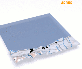 Places with similar names to Janka, Indonesia ::
Disclaimer :: Information on this page comes without warranty of any kind |
||
|
Where is Janka? Elevation and coordinates ::
Latitude (lat): 5°15'38"N Longitude (lon): 96°48'30"E
Elevation (approx.): 8m (map arrows pan, magnifying glasses zoom) |
||
|
Visiting Janka? Hotel/Accommodation ::
Book a hotel in Janka Travel Guide ::
Buy a travel guide for Indonesia rental cars ::
car rental offers GPS waypoint ::
download a GPX waypoint (PoI) of Janka for your GPS receiver
|
||