|
search place name
|
||
Kalbut (Jawa Timur, Indonesia)Kalbut is a town in the Jawa Timur region of Indonesia. An overview map of the region around Kalbut is displayed below.
regional and 3d topo map of Kalbut, Indonesia ::
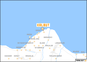
Nearby towns ::
Semiring (0.5km south) //
Gumuk (2.2km west) //
Gumuk-kidul (2.2km west) //
Gumuk-lor (2.2km west) //
Gelung-lor (3.0km south west) //
Kayuputih (3.4km south west) //
Mangaran (4.4km south east) //
Gelung-kidul (4.7km south west) //
Alasmalang (6.0km south west) //
Dawet (6.0km south west) //
Olean (6.4km south) //
Paras (6.3km south west) //
Curahjero (6.7km south) //
Bugur (7.3km south west) //
Brigaan (7.3km south west) //
Petokengan (7.5km south west) //
Panji-lor (7.9km south) //
Situbondo (8.5km south) //
Kapongan (9.2km south east) //
Landangan (9.5km south east) //
Petokengan-barat (9.9km south west) //
Wringinanom (10.0km south west) //
Pauwan (11.2km south west) //
[all distances 'as the bird flies' and approximate] 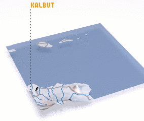 Places with similar names to Kalbut, Indonesia ::
Disclaimer :: Information on this page comes without warranty of any kind |
||
|
Where is Kalbut? Elevation and coordinates ::
Latitude (lat): 7°37'34"S Longitude (lon): 114°1'8"E
Elevation (approx.): 6m (map arrows pan, magnifying glasses zoom) |
||
|
Visiting Kalbut? Hotel/Accommodation ::
Book a hotel in Kalbut Travel Guide ::
Buy a travel guide for Indonesia rental cars ::
car rental offers GPS waypoint ::
download a GPX waypoint (PoI) of Kalbut for your GPS receiver
|
||