|
search place name
|
||
Karangkering (Jawa Timur, Indonesia)Karangkering is a town in the Jawa Timur region of Indonesia. An overview map of the region around Karangkering is displayed below.
regional and 3d topo map of Karangkering, Indonesia ::

Nearby towns ::
Gresik (3.7km north) //
Kebomas (3.8km north west) //
Giri (4.1km north west) //
Lumpur (4.3km north) //
Tanjungan (5.0km north east) //
Pojok (5.1km north) //
Maduran (5.1km north west) //
Tepen (5.7km north) //
Yosowilangun (6.5km north west) //
Kamal (6.7km east) //
Morokrembangan (6.8km south east) //
Banyuajuh (6.9km north east) //
Gilitimur (7.1km north east) //
Tanjungperak (7.2km east) //
Kandangan (7.4km south) //
Gili-timur (7.4km north east) //
Singopadu (7.4km west) //
Sukomulio (7.9km north west) //
Benowo (7.9km south west) //
Suci (7.9km north west) //
Ujung (8.3km east) //
Tanjungjati (8.4km east) //
Kebbun (8.6km east) //
Prapat Kurung (8.6km south east) //
Tenger (9.0km north west) //
Kranggan (9.3km south east) //
Manyarrejo (9.6km north west) //
Krembangan (9.7km south east) //
Manyar (10.0km north west) //
[all distances 'as the bird flies' and approximate] 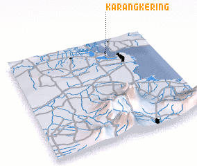 Places with similar names to Karangkering, Indonesia ::
// Gurong Gurong (MY)
Disclaimer :: Information on this page comes without warranty of any kind |
||
|
Where is Karangkering? Elevation and coordinates ::
Latitude (lat): 7°11'12"S Longitude (lon): 112°39'41"E
Elevation (approx.): 6m (map arrows pan, magnifying glasses zoom) |
||
|
Visiting Karangkering? Hotel/Accommodation ::
Book a hotel in Karangkering Travel Guide ::
Buy a travel guide for Indonesia rental cars ::
car rental offers GPS waypoint ::
download a GPX waypoint (PoI) of Karangkering for your GPS receiver
|
||