|
search place name
|
||
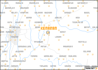
Kenaran (Indonesia)Kenaran is a town in Indonesia. An overview map of the region around Kenaran is displayed below.
regional and 3d topo map of Kenaran, Indonesia ::
Nearby towns ::
Sorogedug (0.0km north) //
Potrojayan (1.8km west) //
Mutihan (2.6km south west) //
Randugunting (3.7km north) //
Wanujoyo (3.7km south) //
Tanjungtirto (4.1km north west) //
Berbah (4.1km north west) //
Losari (4.1km south east) //
Groyokan (4.1km north east) //
Kalasan (5.2km north west) //
Kembang (5.2km north west) //
Piyungan (5.2km south west) //
Serut (5.5km east) //
Patuk (5.9km south) //
Prambanan (5.9km north) //
Maguwo (6.6km north west) //
Jeblog (6.7km north east) //
Nglanggeran (6.7km south east) //
Bugisan (7.4km north) //
Tulung (7.6km north) //
Kaligesing (7.6km east) //
Karanggayam (7.8km south west) //
Salakan (8.3km north west) //
Gantiwarno (8.2km north east) //
Depok (9.2km north west) //
Padangan (9.2km south east) //
Srowot (10.4km north east) //
Gondangwinangun (10.4km north east) //
[all distances 'as the bird flies' and approximate]  Places with similar names to Kenaran, Indonesia ::
Disclaimer :: Information on this page comes without warranty of any kind |
||
|
Where is Kenaran? Elevation and coordinates ::
Latitude (lat): 7°48'0"S Longitude (lon): 110°29'0"E
Elevation (approx.): 106m (map arrows pan, magnifying glasses zoom) |
||
|
Visiting Kenaran? Hotel/Accommodation ::
Book a hotel in Kenaran Travel Guide ::
Buy a travel guide for Indonesia rental cars ::
car rental offers GPS waypoint ::
download a GPX waypoint (PoI) of Kenaran for your GPS receiver
|
||