|
search place name
|
||
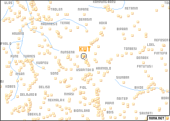
Kut (Nusa Tenggara Timur, Indonesia)Kut is a town in the Nusa Tenggara Timur region of Indonesia. An overview map of the region around Kut is displayed below.
regional and 3d topo map of Kut, Indonesia ::
Kut airports ::
The nearest airport is DIL - Dili Presidente Nicolau Lobato Intl, located 148.6 km north east of Kut.
Nearby towns ::
Nunasili (0.3km north east) //
Bitune (0.3km south east) //
Foko (0.4km south east) //
Sonbai (0.7km south east) //
Tanahputih (0.9km south east) //
Ilneno (1.3km south east) //
Fatunaen (1.9km north west) //
Neofmetan (2.0km south west) //
Bao (2.1km east) //
Kiuana (2.4km west) //
Kaenbaun (2.5km east) //
Bokon (2.7km north east) //
Bespenu (3.0km south) //
Liatoti (3.1km north) //
Tapnati (3.2km south) //
Oefuis (3.2km west) //
Usapitoko (3.2km south) //
Kumeto (3.3km south) //
Bonak (3.5km south east) //
Fainnake (3.6km south west) //
Fatuaeb (3.6km south) //
Nunsena (3.6km west) //
Oehoso (3.8km north) //
Iutleu (3.8km west) //
Puaono (3.9km west) //
Fatusene (3.9km south east) //
Saen (4.1km south) //
Solbeo (4.1km north) //
Letnono (4.2km north east) //
[all distances 'as the bird flies' and approximate] 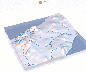 Places with similar names to Kut, Indonesia ::
Disclaimer :: Information on this page comes without warranty of any kind |
||
|
Where is Kut? Elevation and coordinates ::
Latitude (lat): 9°22'6"S Longitude (lon): 124°27'19"E
Elevation (approx.): 472m (map arrows pan, magnifying glasses zoom) |
||
|
Visiting Kut? Hotel/Accommodation ::
Book a hotel in Kut Travel Guide ::
Buy a travel guide for Indonesia rental cars ::
car rental offers GPS waypoint ::
download a GPX waypoint (PoI) of Kut for your GPS receiver
|
||