|
search place name
|
||
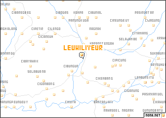
Leuwiliyeur (Indonesia)Leuwiliyeur is a town in Indonesia. An overview map of the region around Leuwiliyeur is displayed below.
regional and 3d topo map of Leuwiliyeur, Indonesia ::
Leuwiliyeur airports ::
The nearest airport is CGK - Jakarta Soekarno Hatta Intl, located 88.7 km north of Leuwiliyeur.
Nearby towns ::
Cimanggu (3.2km south) //
Cibadak (3.3km north) //
Cipeundeuy (3.3km south east) //
Cibungur (3.7km south west) //
Pamuruyan (4.8km north) //
Ubrug (4.8km south west) //
Karangtengah (4.9km north east) //
Cikembar (5.4km south) //
Nagrak (6.5km north east) //
Cicantayan (6.8km east) //
Cikembang (7.4km south east) //
Gunungguruh (7.4km east) //
Parungkuda (7.7km north) //
Bojong (8.3km south east) //
Pasirkandang (8.5km south west) //
Cipicung (8.5km east) //
Cilengo (8.6km north west) //
Jambatan (8.7km east) //
Cicareuh (9.1km north west) //
Lebakjero (9.7km south east) //
Sampora (9.7km south east) //
Ciawtali (10.1km south west) //
Warungkiara (10.3km south west) //
Cigonbong (10.6km south west) //
Cibodas (10.7km south east) //
Cireundeuy (11.3km north east) //
[all distances 'as the bird flies' and approximate] 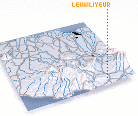 Places with similar names to Leuwiliyeur, Indonesia :: Disclaimer :: Information on this page comes without warranty of any kind |
||
|
Where is Leuwiliyeur? Elevation and coordinates ::
Latitude (lat): 6°55'7"S Longitude (lon): 106°46'26"E
Elevation (approx.): 332m (map arrows pan, magnifying glasses zoom) |
||
|
Visiting Leuwiliyeur? Hotel/Accommodation ::
Book a hotel in Leuwiliyeur Travel Guide ::
Buy a travel guide for Indonesia rental cars ::
car rental offers GPS waypoint ::
download a GPX waypoint (PoI) of Leuwiliyeur for your GPS receiver
|
||