|
search place name
|
||
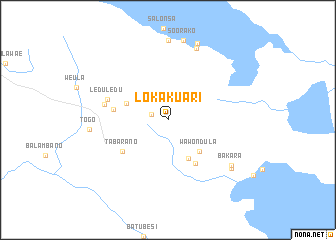
Lokakuari (Sulawesi Selatan, Indonesia)Lokakuari is a town in the Sulawesi Selatan region of Indonesia. An overview map of the region around Lokakuari is displayed below.
regional and 3d topo map of Lokakuari, Indonesia ::
Lokakuari airports ::
The nearest airport is PSJ - Poso Kasiguncu, located 151.3 km north west of Lokakuari.
Other airports nearby include LUW - Luwuk Bubung (234.8 km north east), PLW - Palu Mutiara (244.8 km north west), Nearby towns ::
Palumba (1.9km west) //
Baruga (4.8km south east) //
Wawondula (4.9km south east) //
Sinongko (5.0km west) //
Langkearaya (5.8km south east) //
Lowu (6.2km west) //
Tabarano (6.2km south west) //
Leduledu (7.1km west) //
Wasuponda (7.3km west) //
Lamoare (8.6km north) //
Bakara (8.8km south east) //
Togo (8.8km west) //
Pontada (8.9km north) //
Matompi (8.9km south east) //
Soorako (9.0km north) //
Helai (9.1km north) //
[all distances 'as the bird flies' and approximate] 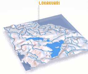 Places with similar names to Lokakuari, Indonesia ::
// La Coquera (CO)
// La Coquera (CO)
// La Coquera (CO)
// Lago Agrio (EC)
// Lokikere (IN)
// Lakaikiri (ID)
// Lugagara (TZ)
// Lukigura (TZ)
// La Agua Agria (HN)
// Laccora (PE)
Disclaimer :: Information on this page comes without warranty of any kind |
||
|
Where is Lokakuari? Elevation and coordinates ::
Latitude (lat): 2°35'59"S Longitude (lon): 121°20'30"E
Elevation (approx.): 710m (map arrows pan, magnifying glasses zoom) |
||
|
Visiting Lokakuari? Hotel/Accommodation ::
Book a hotel in Lokakuari Travel Guide ::
Buy a travel guide for Indonesia rental cars ::
car rental offers GPS waypoint ::
download a GPX waypoint (PoI) of Lokakuari for your GPS receiver
|
||