|
search place name
|
||
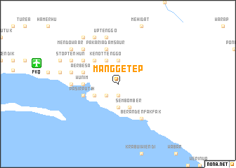
Manggetep (Indonesia)Manggetep is a town in Indonesia. An overview map of the region around Manggetep is displayed below.
regional and 3d topo map of Manggetep, Indonesia ::
Manggetep airports ::
The nearest airport is FKQ - Fak Fak, located 13.3 km west of Manggetep.
Other airports nearby include BXB - Babo (126.1 km east), KNG - Kaimana (164.8 km south east), Nearby towns ::
Nahatpun (1.9km south) //
Kiraoberma (1.9km south) //
Howongtenggo (2.6km south west) //
Wadin Werot Werot (2.6km south west) //
Terukuping (2.6km south west) //
Oawabkenda (3.7km south) //
Hawertabur (3.7km north) //
Kenottenggo (4.1km north west) //
Sembomber (4.1km south east) //
Benno (4.1km south west) //
Mandopkendik (4.1km south west) //
Krarripehi (4.1km south west) //
Pimpihanene (5.2km north west) //
Sie Pen Pen (5.2km north west) //
Wedi Pon Pon (5.6km west) //
Wunim (5.6km west) //
Pakariadamsaur (5.9km north) //
Aer Besar (5.9km west) //
Brongkendik (5.9km west) //
Pasirputih (5.9km west) //
Hobro (6.7km north west) //
Kambarkah (6.7km north west) //
Beranden Fak Fak (6.7km south east) //
Raduria (7.4km west) //
Sorpeha (7.6km west) //
Merapi (7.6km west) //
Uptenggo (7.6km north) //
Bini Mur Mur (7.6km north) //
Mendopma (7.9km north west) //
[all distances 'as the bird flies' and approximate] 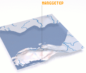 Places with similar names to Manggetep, Indonesia ::
// Munigadpa (IN)
Disclaimer :: Information on this page comes without warranty of any kind |
||
|
Where is Manggetep? Elevation and coordinates ::
Latitude (lat): 2°57'0"S Longitude (lon): 132°23'0"E
Elevation (approx.): 344m (map arrows pan, magnifying glasses zoom) |
||
|
Visiting Manggetep? Hotel/Accommodation ::
Book a hotel in Manggetep Travel Guide ::
Buy a travel guide for Indonesia rental cars ::
car rental offers GPS waypoint ::
download a GPX waypoint (PoI) of Manggetep for your GPS receiver
|
||