|
search place name
|
||
Mangsetan (Indonesia)Mangsetan is a town in Indonesia. An overview map of the region around Mangsetan is displayed below.
regional and 3d topo map of Mangsetan, Indonesia ::

Mangsetan airports ::
The nearest airport is CGK - Jakarta Soekarno Hatta Intl, located 144.5 km west of Mangsetan.
Nearby towns ::
Sewo (1.4km west) //
Sukra (1.8km west) //
Sumuradem (2.3km south east) //
Tegaltaman 1 (3.2km north) //
Pelangeari (3.3km east) //
Kedungdawa (3.9km south west) //
Limpas (4.1km south east) //
Rangdu (4.1km south west) //
Cilandak (4.2km south) //
Enok (4.3km north west) //
Anjatan (4.5km south) //
Karanggnyar (4.5km west) //
Patrol (5.1km south east) //
Curugjati (5.2km north west) //
Ujunggebang (5.4km north) //
Tulangkacang 1 (5.6km south) //
Bugel (5.8km east) //
Bodong (6.1km south west) //
Cigugur (6.3km south west) //
Singjaya (6.7km south west) //
Tulangkacang 2 (7.0km south) //
Karanganyar (7.4km south) //
Kopiah (7.8km south) //
Patimban (7.9km north west) //
Gempol (8.8km west) //
Sukatani 3 (9.2km south) //
Palawangan (9.2km south east) //
Cipahat (9.6km south east) //
[all distances 'as the bird flies' and approximate] 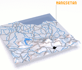 Places with similar names to Mangsetan, Indonesia ::
// Müngsten (DE)
// Monkstown (US)
// Mungastenna (LK)
// Menggau Stone (PG)
// Monkseaton (GB)
// Monxton (GB)
// Monkstown (IE)
// Monkstown (IE)
Disclaimer :: Information on this page comes without warranty of any kind |
||
|
Where is Mangsetan? Elevation and coordinates ::
Latitude (lat): 6°18'0"S Longitude (lon): 107°57'0"E
Elevation (approx.): 6m (map arrows pan, magnifying glasses zoom) |
||
|
Visiting Mangsetan? Hotel/Accommodation ::
Book a hotel in Mangsetan Travel Guide ::
Buy a travel guide for Indonesia rental cars ::
car rental offers GPS waypoint ::
download a GPX waypoint (PoI) of Mangsetan for your GPS receiver
|
||