|
search place name
|
||
Matamanas 2 (Nusa Tenggara Timur, Indonesia)Matamanas 2 is a town in the Nusa Tenggara Timur region of Indonesia. An overview map of the region around Matamanas 2 is displayed below.
regional and 3d topo map of Matamanas 2, Indonesia ::

Matamanas 2 airports ::
The nearest airport is DIL - Dili Presidente Nicolau Lobato Intl, located 125.3 km north east of Matamanas 2.
Nearby towns ::
Eokpuran (1.1km north) //
Maan (1.7km east) //
Klatun (2.2km south east) //
Fatubena (2.7km east) //
Sosonet (3.6km south west) //
Fautloit (3.7km south) //
Kakase (3.8km south) //
Buikon (3.9km north east) //
Loofkau (4.0km south) //
Nunteon (4.1km south) //
Buimetan (4.2km south west) //
Wehae (4.3km north) //
Laleooan (4.4km east) //
Balibo (4.5km south east) //
Kotanan (4.6km south east) //
Lootateu (4.7km east) //
Kortau (4.7km north) //
Fafoik (4.7km east) //
Kotafoun (4.8km south) //
Naitnenas (5.0km south west) //
Neamutu (5.3km north west) //
Kota (5.2km east) //
Neun (5.3km west) //
Tetebaun (5.4km south east) //
Matamanas 1 (5.6km east) //
Rantete (5.8km north west) //
Kuletok (6.0km east) //
Manufu (6.1km south west) //
Takoni (6.1km west) //
[all distances 'as the bird flies' and approximate] 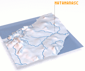 Places with similar names to Matamanas 2, Indonesia :: Disclaimer :: Information on this page comes without warranty of any kind |
||
|
Where is Matamanas 2? Elevation and coordinates ::
Latitude (lat): 9°26'13"S Longitude (lon): 124°49'10"E
Elevation (approx.): 495m (map arrows pan, magnifying glasses zoom) |
||
|
Visiting Matamanas 2? Hotel/Accommodation ::
Book a hotel in Matamanas 2 Travel Guide ::
Buy a travel guide for Indonesia rental cars ::
car rental offers GPS waypoint ::
download a GPX waypoint (PoI) of Matamanas 2 for your GPS receiver
|
||