|
search place name
|
||
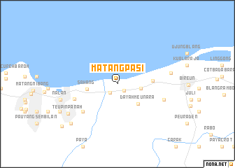
Matangpasi (Aceh, Indonesia)Matangpasi is a town in the Aceh region of Indonesia. An overview map of the region around Matangpasi is displayed below.
regional and 3d topo map of Matangpasi, Indonesia ::
Matangpasi airports ::
The nearest airport is BTJ - Banda Aceh Sultan Iskandarmuda, located 135.3 km west of Matangpasi.
Nearby towns ::
Meunasah (1.5km south east) //
Peudada (1.8km south west) //
Karieng (3.8km east) //
Dayahmeunara (4.6km south east) //
Sawang (4.9km west) //
Teupakbaroh (5.7km east) //
Jambo-dalam (7.1km south west) //
Plimbang (7.3km west) //
Aluekeumuneng (7.8km east) //
Blangblandeh (7.8km east) //
Lipahpayeuk (8.7km east) //
Teupinpanah (9.2km south west) //
Matangkule (9.7km south west) //
Lhokkulam (11.1km south west) //
[all distances 'as the bird flies' and approximate] 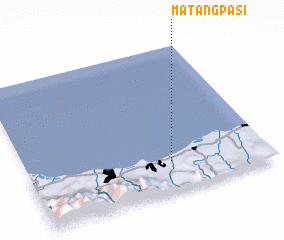 Places with similar names to Matangpasi, Indonesia :: Disclaimer :: Information on this page comes without warranty of any kind |
||
|
Where is Matangpasi? Elevation and coordinates ::
Latitude (lat): 5°12'23"N Longitude (lon): 96°35'59"E
Elevation (approx.): 9m (map arrows pan, magnifying glasses zoom) |
||
|
Visiting Matangpasi? Hotel/Accommodation ::
Book a hotel in Matangpasi Travel Guide ::
Buy a travel guide for Indonesia rental cars ::
car rental offers GPS waypoint ::
download a GPX waypoint (PoI) of Matangpasi for your GPS receiver
|
||