|
search place name
|
||
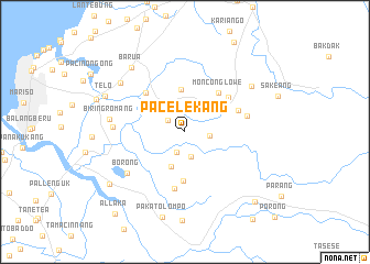
Pacelekang (Sulawesi Selatan, Indonesia)Pacelekang is a town in the Sulawesi Selatan region of Indonesia. An overview map of the region around Pacelekang is displayed below.
regional and 3d topo map of Pacelekang, Indonesia ::
Pacelekang airports ::
The nearest airport is UPG - Ujung Pandang Hasanuddin, located 13.7 km north of Pacelekang.
Nearby towns ::
Moncongmoncong (2.1km north west) //
Lamaru (2.2km south west) //
Balangpunia (2.5km east) //
Bontomaranu (2.6km south) //
Mangempang (3.3km north) //
Borongpalala (3.8km south) //
Diccekang (4.3km north) //
Timbuseng (4.9km south) //
Monconglowe (5.2km north east) //
Pamanjengang (5.6km north west) //
Cilalang (5.6km north east) //
Padangtaring (5.8km east) //
Pakattocaddi (5.8km south) //
Peo (6.5km east) //
Borong (7.2km south west) //
Romanggaya (7.3km west) //
Biringromang (7.8km west) //
Pamalungan (8.1km north west) //
Harapan (8.2km north east) //
Barua (8.5km north west) //
Telo (8.8km north west) //
Pakatolompo (8.9km south) //
Pakato (9.3km south west) //
Bontoparang (10.1km south east) //
Allaka (10.9km south west) //
Kaballokang (11.2km south east) //
[all distances 'as the bird flies' and approximate] 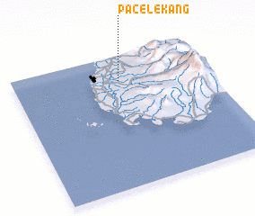 Places with similar names to Pacelekang, Indonesia :: Disclaimer :: Information on this page comes without warranty of any kind |
||
|
Where is Pacelekang? Elevation and coordinates ::
Latitude (lat): 5°11'9"S Longitude (lon): 119°33'9"E
Elevation (approx.): 18m (map arrows pan, magnifying glasses zoom) |
||
|
Visiting Pacelekang? Hotel/Accommodation ::
Book a hotel in Pacelekang Travel Guide ::
Buy a travel guide for Indonesia rental cars ::
car rental offers GPS waypoint ::
download a GPX waypoint (PoI) of Pacelekang for your GPS receiver
|
||