|
search place name
|
||
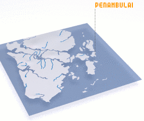
Penambulai (Maluku, Indonesia)Penambulai is a town in the Maluku region of Indonesia. An overview map of the region around Penambulai is displayed below.
regional and 3d topo map of Penambulai, Indonesia ::

Nearby towns ::
 Places with similar names to Penambulai, Indonesia ::
// Peñamil (ES)
// Pine Mill (US)
// Poonamallee (IN)
// Pinamula (ID)
// Panamulla (LK)
// Pannimulla (LK)
// Panmal (KP)
// Pŏnmal (KR)
// Pon-mal (KR)
// Pannoomilloo (AU)
Disclaimer :: Information on this page comes without warranty of any kind |
||
|
Where is Penambulai? Elevation and coordinates ::
Latitude (lat): 6°28'23"S Longitude (lon): 134°49'35"E
Elevation (approx.): -32768m (map arrows pan, magnifying glasses zoom) |
||
|
Visiting Penambulai? Hotel/Accommodation ::
Book a hotel in Penambulai Travel Guide ::
Buy a travel guide for Indonesia rental cars ::
car rental offers GPS waypoint ::
download a GPX waypoint (PoI) of Penambulai for your GPS receiver
|
||