|
search place name
|
||
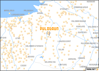
Pulodaun (Jawa Barat, Indonesia)Pulodaun is a town in the Jawa Barat region of Indonesia. An overview map of the region around Pulodaun is displayed below.
regional and 3d topo map of Pulodaun, Indonesia ::
Pulodaun airports ::
The nearest airport is CGK - Jakarta Soekarno Hatta Intl, located 44.1 km west of Pulodaun.
Nearby towns ::
Turi (0.6km south west) //
Tambunbulak (0.7km south east) //
Pangkalan Dua (0.7km north west) //
Pangkalanmalang-ngetan (1.3km north) //
Babelan (1.8km south west) //
Pintu (1.9km south west) //
Kedawung (2.0km north west) //
Kampungbaru (2.4km north) //
Gabussangkil (2.4km south east) //
Bulakgrinting (2.6km east) //
Gempolragas (2.8km north) //
Pulotimaha (2.9km west) //
Kebalen (3.0km south west) //
Wates (3.0km north west) //
Belendung (3.0km north) //
Puokenda (3.1km west) //
Puloasem (3.3km south west) //
Berengkok (4.0km east) //
Gabusrawa (4.1km south) //
Tambun-rawasalak (4.4km north) //
Kalenkendal (4.4km east) //
Penggitungan Tengah (4.9km south) //
Tambun (4.9km north west) //
Babakan Satu (5.0km north) //
Kampungutan (5.1km north) //
Kerangkeng (5.2km north) //
Wangkal (5.2km east) //
Tambunkalapa (5.5km south) //
Tambun (5.4km west) //
[all distances 'as the bird flies' and approximate] 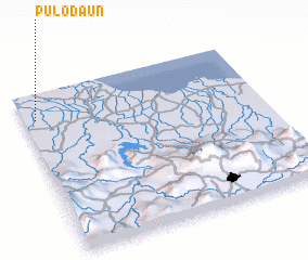 Places with similar names to Pulodaun, Indonesia ::
Disclaimer :: Information on this page comes without warranty of any kind |
||
|
Where is Pulodaun? Elevation and coordinates ::
Latitude (lat): 6°9'28"S Longitude (lon): 107°3'11"E
Elevation (approx.): 4m (map arrows pan, magnifying glasses zoom) |
||
|
Visiting Pulodaun? Hotel/Accommodation ::
Book a hotel in Pulodaun Travel Guide ::
Buy a travel guide for Indonesia rental cars ::
car rental offers GPS waypoint ::
download a GPX waypoint (PoI) of Pulodaun for your GPS receiver
|
||