|
search place name
|
||
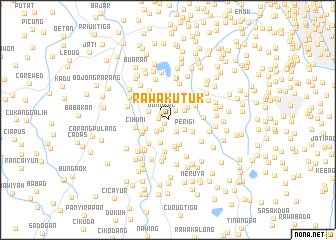
Rawakutuk (Indonesia)Rawakutuk is a town in Indonesia. An overview map of the region around Rawakutuk is displayed below.
regional and 3d topo map of Rawakutuk, Indonesia ::
Rawakutuk airports ::
The nearest airport is CGK - Jakarta Soekarno Hatta Intl, located 14.5 km north of Rawakutuk.
Nearby towns ::
Pondokjagung (0.6km south west) //
Bendungan (0.9km north west) //
Pondokaren Hilir (1.1km west) //
Dongkal (1.1km north west) //
Cileduk 1 (1.3km south west) //
Pondokujung (1.3km north east) //
Pondokkacang (1.6km south east) //
Jelupang (1.8km south west) //
Kebonmanggis (2.1km north east) //
Perigi (2.1km south east) //
Buaran (2.4km north) //
Kandangsampi (2.4km north west) //
Pondokserut (2.4km north east) //
Dutensawit (2.6km north east) //
Kayu-bese (2.6km north) //
Buaran (2.6km south) //
Bojonggintung (2.6km west) //
Kunciran (2.9km north) //
Perigi-kulon (3.0km south) //
Pondokjati (3.0km south east) //
Pondokjengkol (3.0km south east) //
Pondokaren (3.0km south east) //
Perigi-wetan (3.0km south east) //
Priang (3.1km south west) //
Tajur (3.2km north east) //
Jombangkramat (3.3km south) //
Kramat (3.3km south west) //
Babulak (3.4km south west) //
Parungsarab (3.4km north east) //
[all distances 'as the bird flies' and approximate] 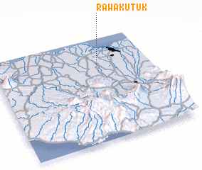 Places with similar names to Rawakutuk, Indonesia :: Disclaimer :: Information on this page comes without warranty of any kind |
||
|
Where is Rawakutuk? Elevation and coordinates ::
Latitude (lat): 6°15'18"S Longitude (lon): 106°40'31"E
Elevation (approx.): 25m (map arrows pan, magnifying glasses zoom) |
||
|
Visiting Rawakutuk? Hotel/Accommodation ::
Book a hotel in Rawakutuk Travel Guide ::
Buy a travel guide for Indonesia rental cars ::
car rental offers GPS waypoint ::
download a GPX waypoint (PoI) of Rawakutuk for your GPS receiver
|
||