|
search place name
|
||
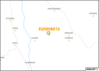
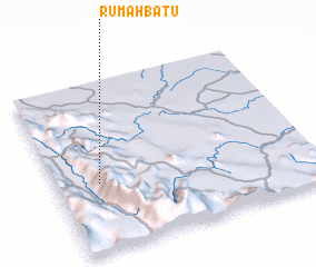
Rumahbatu (Indonesia)Rumahbatu is a town in Indonesia. An overview map of the region around Rumahbatu is displayed below.
regional and 3d topo map of Rumahbatu, Indonesia ::
Rumahbatu airports ::
The nearest airport is PKU - Pekanbaru Sultan Syarif Kasim Ii, located 142.4 km east of Rumahbatu.
Other airports nearby include PDG - Padang Tabing (142.5 km south), DUM - Dumai Pinang Kampai (194.3 km north east), Nearby towns ::
 Places with similar names to Rumahbatu, Indonesia ::
// Rumah Bada (MY)
// Rumah Badi (MY)
// Rumah Buda (MY)
// Rumah Buda (MY)
// Rumah Buda (MY)
// Rumah Buda (MY)
// Roimabad (UZ)
// Rambabat (PG)
Disclaimer :: Information on this page comes without warranty of any kind |
||
|
Where is Rumahbatu? Elevation and coordinates ::
Latitude (lat): 0°24'0"S Longitude (lon): 100°10'0"E
Elevation (approx.): 878m (map arrows pan, magnifying glasses zoom) |
||
|
Visiting Rumahbatu? Hotel/Accommodation ::
Book a hotel in Rumahbatu Travel Guide ::
Buy a travel guide for Indonesia rental cars ::
car rental offers GPS waypoint ::
download a GPX waypoint (PoI) of Rumahbatu for your GPS receiver
|
||