|
search place name
|
||
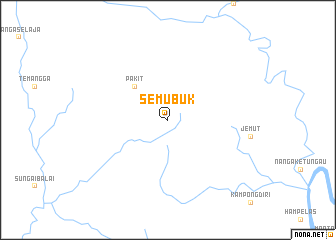
Semubuk (Indonesia)Semubuk is a town in Indonesia. An overview map of the region around Semubuk is displayed below.
regional and 3d topo map of Semubuk, Indonesia ::
Semubuk airports ::
The nearest airport is SQC - Sintang Susilo, located 39.1 km south of Semubuk.
Other airports nearby include KCH - Kuching Intl (173.0 km north west), SBW - Sibu (211.5 km north), Nearby towns ::
Pakit (5.2km north west) //
[all distances 'as the bird flies' and approximate]  Places with similar names to Semubuk, Indonesia ::
// Zemābawk (IN)
// Sambobugu (GH)
// Samia Bakoy (NE)
// Sami Bokoy (NE)
// Samabogo (ML)
// Samaboko (ML)
// Samabougou (ML)
// Sambabougou (ML)
// Sambabougou (ML)
// Somabougou (ML)
Disclaimer :: Information on this page comes without warranty of any kind |
||
|
Where is Semubuk? Elevation and coordinates ::
Latitude (lat): 0°25'0"S Longitude (lon): 111°29'0"E
Elevation (approx.): 38m (map arrows pan, magnifying glasses zoom) |
||
|
Visiting Semubuk? Hotel/Accommodation ::
Book a hotel in Semubuk Travel Guide ::
Buy a travel guide for Indonesia rental cars ::
car rental offers GPS waypoint ::
download a GPX waypoint (PoI) of Semubuk for your GPS receiver
|
||