|
search place name
|
||
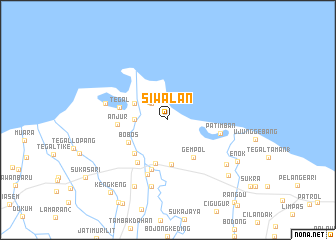
Siwalan (Indonesia)Siwalan is a town in Indonesia. An overview map of the region around Siwalan is displayed below.
regional and 3d topo map of Siwalan, Indonesia ::
Siwalan airports ::
The nearest airport is CGK - Jakarta Soekarno Hatta Intl, located 132.7 km west of Siwalan.
Nearby towns ::
Kalenbalong (2.6km north west) //
Pancer Kulon (2.9km north west) //
Pangarengan (3.7km west) //
Pancer-wetan (4.1km north west) //
Jangbuaya 1 (5.0km south) //
Gempol (5.0km south east) //
Pusakanagara (5.0km south) //
Bobos (5.0km south west) //
Pamanukan-hilir (5.2km south west) //
Tegal (5.6km west) //
Anjur (5.6km west) //
Bojonggayam (5.9km south) //
Pamanukan (5.9km south west) //
Patimban (6.0km east) //
Lolongokan (6.5km south) //
Mayangan (7.2km west) //
Rancah-hilir (7.6km south) //
Curugjati (8.2km south east) //
Rancasari (8.3km south west) //
Enok (9.0km south east) //
Karanggnyar (9.1km south east) //
Kengkeng (10.3km south west) //
[all distances 'as the bird flies' and approximate] 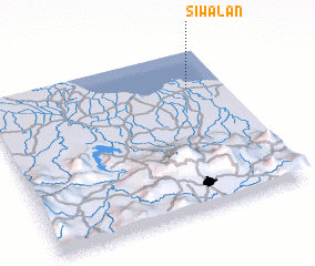 Places with similar names to Siwalan, Indonesia ::
Disclaimer :: Information on this page comes without warranty of any kind |
||
|
Where is Siwalan? Elevation and coordinates ::
Latitude (lat): 6°14'0"S Longitude (lon): 107°51'0"E
(map arrows pan, magnifying glasses zoom) |
||
|
Visiting Siwalan? Hotel/Accommodation ::
Book a hotel in Siwalan Travel Guide ::
Buy a travel guide for Indonesia rental cars ::
car rental offers GPS waypoint ::
download a GPX waypoint (PoI) of Siwalan for your GPS receiver
|
||