|
search place name
|
||
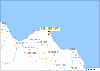
Tamasofo (Sulawesi Tengah, Indonesia)Tamasofo is a town in the Sulawesi Tengah region of Indonesia. An overview map of the region around Tamasofo is displayed below.
regional and 3d topo map of Tamasofo, Indonesia ::
Tamasofo airports ::
The nearest airport is PLW - Palu Mutiara, located 56.3 km west of Tamasofo.
Other airports nearby include PSJ - Poso Kasiguncu (59.2 km south east), Nearby towns ::
Malakosa (1.9km south east) //
Tamanbali (2.1km south west) //
Padangsari (3.7km south) //
Sekarsari (4.6km south west) //
Puntuli (5.4km west) //
Bajrosari (6.1km south west) //
Anggungan (6.8km south) //
Sekarmukti (6.9km south west) //
Anggunan (6.9km south) //
Sekarmukti (6.9km south west) //
Kasihsari (7.4km south west) //
Kerobokan (7.4km south) //
Dewataluhursari (8.8km south) //
Candrabuana (9.1km south west) //
Angsri (9.2km south) //
Buanasari (9.6km south west) //
Buanasari (9.7km south west) //
Telagasari (10.6km south west) //
Piore (10.6km south east) //
Piore (10.7km south east) //
[all distances 'as the bird flies' and approximate] 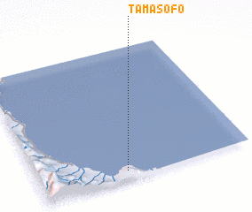 Places with similar names to Tamasofo, Indonesia ::
Disclaimer :: Information on this page comes without warranty of any kind |
||
|
Where is Tamasofo? Elevation and coordinates ::
Latitude (lat): 0°56'24"S Longitude (lon): 120°24'54"E
Elevation (approx.): 9m (map arrows pan, magnifying glasses zoom) |
||
|
Visiting Tamasofo? Hotel/Accommodation ::
Book a hotel in Tamasofo Travel Guide ::
Buy a travel guide for Indonesia rental cars ::
car rental offers GPS waypoint ::
download a GPX waypoint (PoI) of Tamasofo for your GPS receiver
|
||