|
search place name
|
||
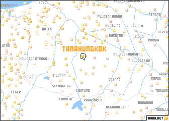
Tanahungkok (Jawa Barat, Indonesia)Tanahungkok is a town in the Jawa Barat region of Indonesia. An overview map of the region around Tanahungkok is displayed below.
regional and 3d topo map of Tanahungkok, Indonesia ::
Tanahungkok airports ::
The nearest airport is CGK - Jakarta Soekarno Hatta Intl, located 50.0 km west of Tanahungkok.
Nearby towns ::
Luwungsepat (1.1km north) //
Telar (2.2km south) //
Tambelang (2.3km east) //
Kesambisepuhun (2.4km south east) //
Sasakbahar (2.9km south) //
Pisangbatu (3.3km south east) //
Tambunkalapa (4.0km west) //
Kalenkendal (4.1km north) //
Gabusrawa (4.2km west) //
Jejalen (4.6km south west) //
Mulotiga (4.6km east) //
Gabussangkil (4.7km north west) //
Buwek (4.7km south west) //
Berengkok (4.7km north) //
Pengarengan-poncol (4.8km north) //
Rengaslempeng (4.8km north east) //
Gonurong (4.8km south west) //
Selangbojong Dua (4.9km south) //
Wangkal (5.1km north) //
Pulaukukun Satu (5.1km east) //
Bulakgrinting (5.5km north west) //
Balongrinih (5.5km north east) //
Balong (5.7km north east) //
Balongampel (5.8km north) //
Pengarengan (5.9km north) //
Balongasem (6.3km north east) //
Tambunbulak (6.3km north west) //
Balonggubuk (6.4km north east) //
Wangkal (6.7km south east) //
[all distances 'as the bird flies' and approximate]  Places with similar names to Tanahungkok, Indonesia :: Disclaimer :: Information on this page comes without warranty of any kind |
||
|
Where is Tanahungkok? Elevation and coordinates ::
Latitude (lat): 6°11'49"S Longitude (lon): 107°6'7"E
Elevation (approx.): 10m (map arrows pan, magnifying glasses zoom) |
||
|
Visiting Tanahungkok? Hotel/Accommodation ::
Book a hotel in Tanahungkok Travel Guide ::
Buy a travel guide for Indonesia rental cars ::
car rental offers GPS waypoint ::
download a GPX waypoint (PoI) of Tanahungkok for your GPS receiver
|
||