|
search place name
|
||
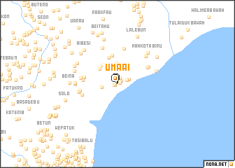
Umaai (Nusa Tenggara Timur, Indonesia)Umaai is a town in the Nusa Tenggara Timur region of Indonesia. An overview map of the region around Umaai is displayed below.
regional and 3d topo map of Umaai, Indonesia ::
Umaai airports ::
The nearest airport is DIL - Dili Presidente Nicolau Lobato Intl, located 119.8 km north east of Umaai.
Nearby towns ::
Umaai (0.2km north) //
Wermasa (0.4km east) //
Welasakar (0.5km south west) //
Welasakar (0.5km west) //
Umabaris (0.5km north east) //
Nularan (0.8km north east) //
Wemasa (1.0km north) //
Sukabesikun (1.6km east) //
Oburo (2.0km east) //
Morokren (2.5km west) //
Halibot (3.2km north) //
Naikasak (3.7km north west) //
Haefehan (3.8km north west) //
Fatukren (4.4km north) //
Halifehan (4.6km north) //
Welaus (5.4km west) //
Raimetan (5.4km north east) //
Kotafun (5.5km west) //
Nafalus (5.7km north east) //
Aibaki (5.8km north) //
Taloulun (5.9km west) //
Fatukres (5.9km west) //
Kotafoun (5.9km west) //
Nuduren (6.2km north) //
Kada (6.2km west) //
Molosoan (6.3km north east) //
Namfalus (6.4km east) //
Mekakeu (6.7km west) //
Sukabihanawa (6.7km west) //
[all distances 'as the bird flies' and approximate] 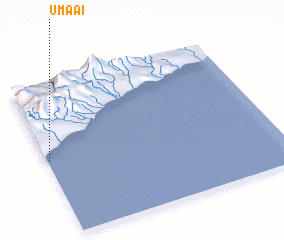 Places with similar names to Umaai, Indonesia ::
Disclaimer :: Information on this page comes without warranty of any kind |
||
|
Where is Umaai? Elevation and coordinates ::
Latitude (lat): 9°30'6"S Longitude (lon): 125°0'40"E
Elevation (approx.): 8m (map arrows pan, magnifying glasses zoom) |
||
|
Visiting Umaai? Hotel/Accommodation ::
Book a hotel in Umaai Travel Guide ::
Buy a travel guide for Indonesia rental cars ::
car rental offers GPS waypoint ::
download a GPX waypoint (PoI) of Umaai for your GPS receiver
|
||