|
search place name
|
||
Utansaga (Jawa Barat, Indonesia)Utansaga is a town in the Jawa Barat region of Indonesia. An overview map of the region around Utansaga is displayed below.
regional and 3d topo map of Utansaga, Indonesia ::

Utansaga airports ::
The nearest airport is CGK - Jakarta Soekarno Hatta Intl, located 50.2 km west of Utansaga.
Nearby towns ::
Utanasem (0.6km north) //
Utanjati (0.9km north) //
Gebangtinggi (1.1km north west) //
Utankramat (1.3km north west) //
Pulobantar (1.3km east) //
Utanringin (1.3km east) //
Kukun (1.4km north west) //
Pilang (1.5km west) //
Kepuh (1.7km west) //
Galian (2.1km south east) //
Pulonangka (2.2km east) //
Galian-lobangbuaya (2.2km south west) //
Kedungringin (2.5km west) //
Pulolamaran (2.7km south) //
Pulorengas (2.8km east) //
Puloapit (3.0km south) //
Terusan (3.1km north east) //
Genting (3.1km west) //
Kalenremeng (3.2km south) //
Kampungcap (3.4km north) //
Telukgarut (3.5km north east) //
Wangkal (3.6km east) //
Telagaherang (4.0km north east) //
Pulopanjang (4.2km east) //
Gombong (4.2km south east) //
Kedung (4.3km south) //
Gempoltinggi (4.6km south) //
Tepakserang (4.6km east) //
Cabangdua Satu (5.0km north west) //
[all distances 'as the bird flies' and approximate] 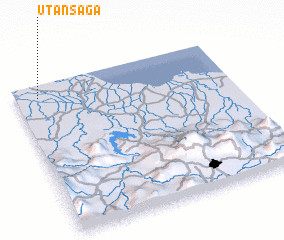 Places with similar names to Utansaga, Indonesia ::
// Udinsk (RU)
Disclaimer :: Information on this page comes without warranty of any kind |
||
|
Where is Utansaga? Elevation and coordinates ::
Latitude (lat): 6°5'9"S Longitude (lon): 107°6'28"E
Elevation (approx.): 5m (map arrows pan, magnifying glasses zoom) |
||
|
Visiting Utansaga? Hotel/Accommodation ::
Book a hotel in Utansaga Travel Guide ::
Buy a travel guide for Indonesia rental cars ::
car rental offers GPS waypoint ::
download a GPX waypoint (PoI) of Utansaga for your GPS receiver
|
||