|
search place name
|
||
Dolgaec (Macedonia, The Republic of)Dolgaec is a town in Macedonia, The Republic of. An overview map of the region around Dolgaec is displayed below.
regional and 3d topo map of Dolgaec, Macedonia, The Republic of ::

Dolgaec airports ::
The nearest airport is SKP - Skopje, located 51.6 km north east of Dolgaec.
Other airports nearby include OHD - Ohrid (66.1 km south west), PRN - Pristina (118.6 km north), KSO - Kastoria Aristotelis (121.2 km south), TIA - Tirana Rinas (138.9 km west), Nearby towns ::
Margari (0.9km west) //
Zrze (2.8km south west) //
Crnilište (3.4km east) //
Slivje (4.6km south) //
Strovija (4.2km north east) //
Kostinci (4.6km south east) //
Rilevo (5.6km south) //
Gostiražni (5.1km north east) //
Sekirci (7.0km south east) //
Krapa (5.8km west) //
Peštalevo (8.3km south) //
Debrešte (8.0km south west) //
Slepče (7.4km south east) //
[all distances 'as the bird flies' and approximate] 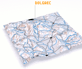 Places with similar names to Dolgaec, Macedonia, The Republic of ::
Disclaimer :: Information on this page comes without warranty of any kind |
||
|
Where is Dolgaec? Elevation and coordinates ::
Latitude (lat): 41°32'7"N Longitude (lon): 21°22'32"E
Elevation (approx.): 697m (map arrows pan, magnifying glasses zoom) |
||
|
Visiting Dolgaec? Hotel/Accommodation ::
Book a hotel in Dolgaec Travel Guide ::
rental cars ::
car rental offers GPS waypoint ::
download a GPX waypoint (PoI) of Dolgaec for your GPS receiver
|
||