|
search place name
|
||
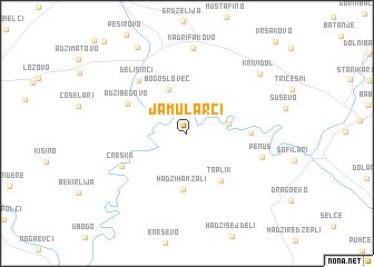
Jamularci (Macedonia, The Republic of)Jamularci is a town in Macedonia, The Republic of. An overview map of the region around Jamularci is displayed below.
regional and 3d topo map of Jamularci, Macedonia, The Republic of ::
Jamularci airports ::
The nearest airport is SKP - Skopje, located 43.0 km north west of Jamularci.
Other airports nearby include OHD - Ohrid (124.6 km south west), PRN - Pristina (124.8 km north west), SOF - Sofia (155.4 km north east), SKG - Thessaloniki Makedonia (155.9 km south east), Nearby towns ::
Dobrošani (3.3km east) //
Bogoslovec (4.6km north) //
Hadži Hamzali (5.7km south) //
Toplik (5.4km south east) //
Testemelci (4.8km east) //
Adžibegovo (5.4km north west) //
Delisinci (6.5km north west) //
Creška (5.8km south west) //
Penuš (6.1km south east) //
Kadrifakovo (8.5km north) //
Krivi Dol (8.0km north east) //
Amzabegovo (9.4km north west) //
[all distances 'as the bird flies' and approximate]  Places with similar names to Jamularci, Macedonia, The Republic of :: Disclaimer :: Information on this page comes without warranty of any kind |
||
|
Where is Jamularci? Elevation and coordinates ::
Latitude (lat): 41°44'2"N Longitude (lon): 22°2'22"E
Elevation (approx.): 285m (map arrows pan, magnifying glasses zoom) |
||
|
Visiting Jamularci? Hotel/Accommodation ::
Book a hotel in Jamularci Travel Guide ::
rental cars ::
car rental offers GPS waypoint ::
download a GPX waypoint (PoI) of Jamularci for your GPS receiver
|
||