|
search place name
|
||
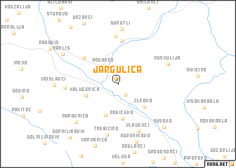
Jargulica (Macedonia, The Republic of)Jargulica is a town in Macedonia, The Republic of. An overview map of the region around Jargulica is displayed below.
regional and 3d topo map of Jargulica, Macedonia, The Republic of ::
Jargulica airports ::
The nearest airport is SKP - Skopje, located 88.5 km north west of Jargulica.
Other airports nearby include SKG - Thessaloniki Makedonia (123.5 km south), SOF - Sofia (141.4 km north east), KZI - Kozani Filippos (156.8 km south west), OHD - Ohrid (158.8 km west), Nearby towns ::
Pokrajčevo (1.9km south east) //
Podareš (3.3km north west) //
Dukatino (5.1km south) //
Kalugerica (4.2km south west) //
Zleovo (4.7km south east) //
Radičevo (5.5km south) //
Oraovica (5.9km north west) //
Sariđol (6.9km north) //
Hudaverlija (7.6km north) //
Vladevci (7.8km south) //
Trebičino (8.1km south) //
Suldurci (6.4km west) //
Kuškulija (6.7km north east) //
Durutli (8.8km north) //
Papavnica (7.8km south west) //
Suševo (8.7km south east) //
Rakliš (8.1km north west) //
Gorni Lipovik (10.2km south west) //
[all distances 'as the bird flies' and approximate]  Places with similar names to Jargulica, Macedonia, The Republic of :: Disclaimer :: Information on this page comes without warranty of any kind |
||
|
Where is Jargulica? Elevation and coordinates ::
Latitude (lat): 41°35'16"N Longitude (lon): 22°33'43"E
Elevation (approx.): 332m (map arrows pan, magnifying glasses zoom) |
||
|
Visiting Jargulica? Hotel/Accommodation ::
Book a hotel in Jargulica Travel Guide ::
rental cars ::
car rental offers GPS waypoint ::
download a GPX waypoint (PoI) of Jargulica for your GPS receiver
|
||