|
search place name
|
||
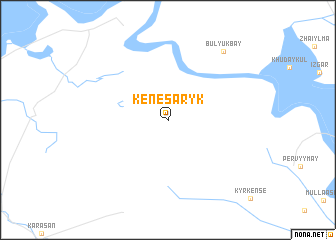
Kenes-Aryk (Kökshetaū, Kazakhstan)Kenes-Aryk is a town in the Kökshetaū region of Kazakhstan. An overview map of the region around Kenes-Aryk is displayed below.
regional and 3d topo map of Kenes-Aryk, Kazakhstan ::
Nearby towns ::
Bulyuk-Bay (8.9km north east) //
[all distances 'as the bird flies' and approximate]  Places with similar names to Kenes-Aryk, Kazakhstan ::
// Kānī Sārk (IQ)
// Kānī Sārkī (IQ)
// Canaseraga (US)
// Ganzourgou (BF)
// Kaynazarka (KZ)
// Kenesaryk (KZ)
// Ganséraké (MR)
// Kānī Sorkh (IR)
// Kānī Sorkh (IR)
// Kān Sorkh (IR)
Disclaimer :: Information on this page comes without warranty of any kind |
||
|
Where is Kenes-Aryk? Elevation and coordinates ::
Latitude (lat): 43°52'52"N Longitude (lon): 67°2'39"E
Elevation (approx.): 160m (map arrows pan, magnifying glasses zoom) |
||
|
Visiting Kenes-Aryk? Hotel/Accommodation ::
Book a hotel in Kenes-Aryk Travel Guide ::
Buy a travel guide for Kazakhstan rental cars ::
car rental offers GPS waypoint ::
download a GPX waypoint (PoI) of Kenes-Aryk for your GPS receiver
|
||