|
search place name
|
||
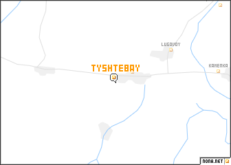
Tyshtebay (Kökshetaū, Kazakhstan)Tyshtebay is a town in the Kökshetaū region of Kazakhstan. An overview map of the region around Tyshtebay is displayed below.
regional and 3d topo map of Tyshtebay, Kazakhstan ::
Tyshtebay airports ::
The nearest airport is DMB - Dzhambul Taraz, located 112.8 km west of Tyshtebay.
Other airports nearby include FRU - Bishkek Manas (147.4 km east), Nearby towns ::
 Places with similar names to Tyshtebay, Kazakhstan ::
// Dāsh Deybī (IR)
// Dāshdībī (IR)
// Dasht Āb (IR)
// Dashtāb (IR)
// Dasht-e Ābī (IR)
// Doāi Chaitāba (BD)
// Tashtebe (KG)
Disclaimer :: Information on this page comes without warranty of any kind |
||
|
Where is Tyshtebay? Elevation and coordinates ::
Latitude (lat): 42°54'0"N Longitude (lon): 72°41'0"E
Elevation (approx.): 731m (map arrows pan, magnifying glasses zoom) |
||
|
Visiting Tyshtebay? Hotel/Accommodation ::
Book a hotel in Tyshtebay Travel Guide ::
Buy a travel guide for Kazakhstan rental cars ::
car rental offers GPS waypoint ::
download a GPX waypoint (PoI) of Tyshtebay for your GPS receiver
|
||