|
search place name
|
||
Gicheha (Central, Kenya)Gicheha is a town in the Central region of Kenya. An overview map of the region around Gicheha is displayed below.
regional and 3d topo map of Gicheha, Kenya ::

Gicheha airports ::
The nearest airport is WIL - Nairobi Wilson, located 35.6 km south of Gicheha.
Other airports nearby include EDL - Eldoret Intl (244.1 km north west), KTL - Kitale (309.6 km north west), Nearby towns ::
Githunguru (0.0km north) //
Mutomo (1.9km south) //
Gatundu (1.9km east) //
Ituru (1.9km north) //
Kamunyuini (1.9km north) //
Wamwangi (1.9km north) //
Githuya (1.9km north) //
Gatundu (1.9km west) //
Gathage (2.6km south west) //
Karembu (2.6km south west) //
Kahunguini (2.6km south west) //
Gaithege (2.6km north west) //
Wamitaa (3.7km south) //
Chegeini (3.7km south) //
Gathagi (3.7km south) //
Githigui (3.7km south) //
Mukuruwe (3.7km east) //
Karia (3.7km north) //
Gatundu (4.1km south west) //
Githunguri (4.1km south west) //
Mangu (4.1km north east) //
Kiriko (4.1km south west) //
Kagumoini (4.1km north west) //
Gatei (4.1km north west) //
Kimunyu (5.2km south east) //
Kimunyu (5.2km north east) //
Nembu (5.2km south west) //
Ichachiri (5.2km north west) //
Kiamwangi (5.6km west) //
[all distances 'as the bird flies' and approximate] 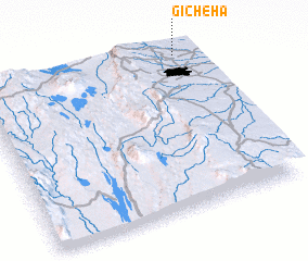 Places with similar names to Gicheha, Kenya ::
Disclaimer :: Information on this page comes without warranty of any kind |
||
|
Where is Gicheha? Elevation and coordinates ::
Latitude (lat): 1°1'0"S Longitude (lon): 36°55'0"E
Elevation (approx.): 1677m (map arrows pan, magnifying glasses zoom) |
||
|
Visiting Gicheha? Hotel/Accommodation ::
Book a hotel in Gicheha Travel Guide ::
Buy a travel guide for Kenya rental cars ::
car rental offers GPS waypoint ::
download a GPX waypoint (PoI) of Gicheha for your GPS receiver
|
||