|
search place name
|
||
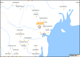
Jego (Coast, Kenya)Jego is a town in the Coast region of Kenya. An overview map of the region around Jego is displayed below.
regional and 3d topo map of Jego, Kenya ::
Jego airports ::
The nearest airport is TGT - Tanga, located 50.5 km south of Jego.
Other airports nearby include MBA - Mombasa Moi Intl (81.9 km north east), PMA - Pemba (96.8 km south east), ZNZ - Zanzibar (173.9 km south), Nearby towns ::
Jasini (1.9km south) //
Maguguni (2.6km north east) //
Kikwezani (2.6km south east) //
Kiwegu (2.6km north east) //
Mguya (2.6km south east) //
Kaufumbani (3.7km east) //
Kendwa (4.1km south east) //
Mwarongo (4.1km north east) //
Bazo (4.1km south east) //
Jambe (5.9km north) //
Kidomaya (7.6km north) //
Dzirive (7.6km north) //
Zitengeni (7.8km south west) //
Zigaya (9.2km south west) //
Kirau (9.2km south west) //
Mvumoni (9.3km south west) //
Jikangeni (10.5km south west) //
Nikanyewe (10.5km south west) //
[all distances 'as the bird flies' and approximate] 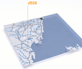 Places with similar names to Jego, Kenya ::
Disclaimer :: Information on this page comes without warranty of any kind |
||
|
Where is Jego? Elevation and coordinates ::
Latitude (lat): 4°39'0"S Longitude (lon): 39°11'0"E
Elevation (approx.): 12m (map arrows pan, magnifying glasses zoom) |
||
|
Visiting Jego? Hotel/Accommodation ::
Book a hotel in Jego Travel Guide ::
Buy a travel guide for Kenya rental cars ::
car rental offers GPS waypoint ::
download a GPX waypoint (PoI) of Jego for your GPS receiver
|
||