|
search place name
|
||
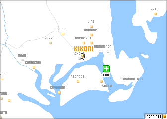
Kikoni (Coast, Kenya)Kikoni is a town in the Coast region of Kenya. An overview map of the region around Kikoni is displayed below.
regional and 3d topo map of Kikoni, Kenya ::
Kikoni airports ::
The nearest airport is LAU - Lamu Manda, located 5.6 km east of Kikoni.
Other airports nearby include MBA - Mombasa Moi Intl (244.3 km south west), KMU - Kismayu Kisimayu (271.2 km north east), Nearby towns ::
Mokowe (0.9km west) //
Bora Imani (3.7km north) //
Kimari Maganga (4.1km north east) //
Mashundwani (4.1km north east) //
Matondoni (5.1km south) //
Kililana (5.9km east) //
Simandaro (5.9km north) //
Lamu (6.5km south east) //
Kikomani (6.7km south east) //
Hindi (7.4km north west) //
Jipe (7.6km north) //
Safarisi (8.3km north west) //
Shela (9.0km south east) //
Kipungani (9.3km south west) //
[all distances 'as the bird flies' and approximate] 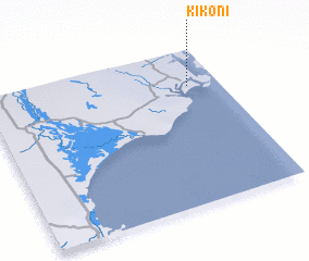 Places with similar names to Kikoni, Kenya ::
Disclaimer :: Information on this page comes without warranty of any kind |
||
|
Where is Kikoni? Elevation and coordinates ::
Latitude (lat): 2°14'0"S Longitude (lon): 40°52'0"E
Elevation (approx.): 5m (map arrows pan, magnifying glasses zoom) |
||
|
Visiting Kikoni? Hotel/Accommodation ::
Book a hotel in Kikoni Travel Guide ::
Buy a travel guide for Kenya rental cars ::
car rental offers GPS waypoint ::
download a GPX waypoint (PoI) of Kikoni for your GPS receiver
|
||