|
search place name
|
||
Muchatha (Nairobi, Kenya)Muchatha is a town in the Nairobi region of Kenya. An overview map of the region around Muchatha is displayed below.
regional and 3d topo map of Muchatha, Kenya ::

nearby GPS traces from timatio ::
Muchatha airports ::
The nearest airport is WIL - Nairobi Wilson, located 13.9 km south of Muchatha.
Other airports nearby include EDL - Eldoret Intl (247.0 km north west), Nearby towns ::
Ruaka (0.0km north) //
Yamogo (1.9km west) //
Gachie (1.9km south) //
Waguthu (1.9km north) //
Karura (2.6km south west) //
Thimbigua (2.6km north west) //
Gathanga (2.6km north east) //
Kanunga (3.7km north) //
Toritu (4.1km north east) //
Gathiga (4.1km south west) //
Karuri (4.1km north west) //
Kihara (4.1km south west) //
Ndenderu (4.1km north west) //
Muthurua (5.2km north west) //
Kiambaa (5.2km north west) //
Kangoya (5.2km north east) //
Spring Valley (5.6km south) //
Karura Kanyungu (5.6km west) //
Ndumberi (5.9km north) //
Highridge (5.9km south) //
Parklands (5.9km south) //
Kianjogu (5.9km west) //
Riabai (6.7km north east) //
Kiambu (6.7km north east) //
Kiambaa (6.7km north west) //
Laini (6.7km north west) //
Njiku (6.7km north west) //
Gichocho (6.7km north east) //
Karunga (6.7km north east) //
[all distances 'as the bird flies' and approximate] 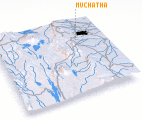 Places with similar names to Muchatha, Kenya :: Disclaimer :: Information on this page comes without warranty of any kind |
||
|
Where is Muchatha? Elevation and coordinates ::
Latitude (lat): 1°12'0"S Longitude (lon): 36°47'0"E
Elevation (approx.): 1749m (map arrows pan, magnifying glasses zoom) |
||
|
Visiting Muchatha? Hotel/Accommodation ::
Book a hotel in Muchatha Travel Guide ::
Buy a travel guide for Kenya rental cars ::
car rental offers GPS waypoint ::
download a GPX waypoint (PoI) of Muchatha for your GPS receiver
|
||