|
search place name
|
||
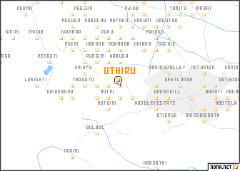
Uthiru (Nairobi, Kenya)Uthiru is a town in the Nairobi region of Kenya. An overview map of the region around Uthiru is displayed below.
regional and 3d topo map of Uthiru, Kenya ::
nearby GPS traces from timatio ::
Uthiru airports ::
The nearest airport is WIL - Nairobi Wilson, located 12.5 km south east of Uthiru.
Other airports nearby include EDL - Eldoret Intl (247.4 km north west), KIS - Kisumu (256.9 km north west), Nearby towns ::
Kabete (0.0km north) //
Waithaka (1.9km south) //
Kagondo (1.9km west) //
Riruta (2.6km south east) //
Kwangwari (2.6km south east) //
Mutei (2.6km south west) //
Mbari Ya Njiru (2.6km south west) //
Kidono (2.6km north west) //
Kinoo (2.6km north west) //
Lusigeti (3.7km west) //
Gichongo (3.7km west) //
Kiawanugu (3.7km north) //
Mararo (3.7km north) //
Lower Kabete (3.7km north) //
Kanyongo (3.7km north) //
Wabuga (3.7km north) //
Mutuini (4.1km south west) //
Kibiriraini (4.1km south west) //
Kanyariri (4.1km north west) //
Rukubi (4.1km north west) //
Ndurarua (4.1km north west) //
Ngure (5.2km north west) //
Rungiri (5.2km north west) //
Gitaru (5.2km north west) //
Thogoto (5.6km west) //
Ngababa (5.6km north) //
Kiahuria (5.6km north) //
Benhard Estate (5.6km east) //
Thomson Estate (5.9km east) //
[all distances 'as the bird flies' and approximate] 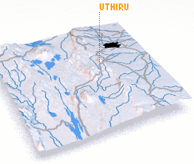 Places with similar names to Uthiru, Kenya ::
// Uthari (BD)
Disclaimer :: Information on this page comes without warranty of any kind |
||
|
Where is Uthiru? Elevation and coordinates ::
Latitude (lat): 1°16'0"S Longitude (lon): 36°43'0"E
Elevation (approx.): 1899m (map arrows pan, magnifying glasses zoom) |
||
|
Visiting Uthiru? Hotel/Accommodation ::
Book a hotel in Uthiru Travel Guide ::
Buy a travel guide for Kenya rental cars ::
car rental offers GPS waypoint ::
download a GPX waypoint (PoI) of Uthiru for your GPS receiver
|
||