|
search place name
|
||
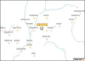
Abiane (Woleu-Ntem, Gabon)Abiane is a town in the Woleu-Ntem region of Gabon. An overview map of the region around Abiane is displayed below.
regional and 3d topo map of Abiane, Gabon ::
Abiane airports ::
The nearest airport is OYE - Oyem, located 106.8 km north of Abiane.
Other airports nearby include BMM - Bitam (160.6 km north), LBQ - Lambarene (184.7 km south west), MKU - Makokou (186.5 km east), LBV - Libreville Leon M Ba (202.0 km west), Nearby towns ::
Akour-Kok (1.9km east) //
Essone (3.7km east) //
Akourman (3.7km west) //
Akineyon (4.1km south east) //
Mfaye (5.9km north) //
Mimbong (5.9km west) //
Aténé (5.9km west) //
Abang (5.9km east) //
Akourmar (6.7km north west) //
Ngoum (7.6km east) //
Angone (7.9km south west) //
Mvoulessi (8.3km north west) //
Oveng (9.3km south west) //
[all distances 'as the bird flies' and approximate] 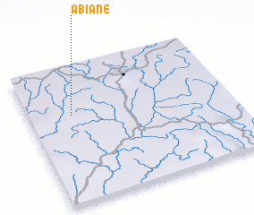 Places with similar names to Abiane, Gabon ::
Disclaimer :: Information on this page comes without warranty of any kind |
||
|
Where is Abiane? Elevation and coordinates ::
Latitude (lat): 0°39'0"S Longitude (lon): 11°13'0"E
Elevation (approx.): 536m (map arrows pan, magnifying glasses zoom) |
||
|
Visiting Abiane? Hotel/Accommodation ::
Book a hotel in Abiane Travel Guide ::
Buy a travel guide for Gabon rental cars ::
car rental offers GPS waypoint ::
download a GPX waypoint (PoI) of Abiane for your GPS receiver
|
||