|
search place name
|
||
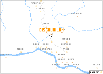
Bissoubilam (Ogooué-Ivindo, Gabon)Bissoubilam is a town in the Ogooué-Ivindo region of Gabon. An overview map of the region around Bissoubilam is displayed below.
regional and 3d topo map of Bissoubilam, Gabon ::
Bissoubilam airports ::
The nearest airport is MKU - Makokou, located 126.9 km north east of Bissoubilam.
Other airports nearby include OYE - Oyem (176.5 km north), LBQ - Lambarene (200.9 km west), OKN - Okondja (208.3 km east), MVB - Franceville Mvengue (248.1 km south east), Nearby towns ::
Duradzoma (1.9km south) //
Mayené II (2.6km north west) //
Kékélé (4.1km north east) //
Mimvoul (4.1km south west) //
Akoba (4.1km north west) //
Malaré (5.2km south west) //
Mitsaga (5.2km south west) //
Mahiboré (5.6km south) //
Massako (5.9km east) //
Ibakodia (5.9km south) //
Maoukafan (5.9km south) //
Akighilam (6.7km south east) //
Makoubou (6.7km south east) //
Okano (6.7km south west) //
Ntoua (7.9km south east) //
Mbembam (8.3km south east) //
[all distances 'as the bird flies' and approximate] 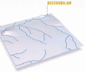 Places with similar names to Bissoubilam, Gabon ::
// Bisobilam (GA)
// Bissobilam (GA)
// Bissobilam (GA)
// Bissobilam (GA)
// Bissobilam (GA)
// Bissobilam (GA)
// Bissoubilam (GA)
Disclaimer :: Information on this page comes without warranty of any kind |
||
|
Where is Bissoubilam? Elevation and coordinates ::
Latitude (lat): 0°1'0"S Longitude (lon): 11°55'0"E
Elevation (approx.): 278m (map arrows pan, magnifying glasses zoom) |
||
|
Visiting Bissoubilam? Hotel/Accommodation ::
Book a hotel in Bissoubilam Travel Guide ::
Buy a travel guide for Gabon rental cars ::
car rental offers GPS waypoint ::
download a GPX waypoint (PoI) of Bissoubilam for your GPS receiver
|
||