|
search place name
|
||
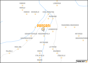
Pangani (Ogooué-Lolo, Gabon)Pangani is a town in the Ogooué-Lolo region of Gabon. An overview map of the region around Pangani is displayed below.
regional and 3d topo map of Pangani, Gabon ::
Pangani airports ::
The nearest airport is MVB - Franceville Mvengue, located 119.3 km south east of Pangani.
Other airports nearby include OKN - Okondja (146.7 km north east), MKU - Makokou (202.3 km north), Nearby towns ::
Moukouagna (1.9km north) //
Mogombofala (1.9km south) //
Lambaréné (3.7km east) //
Midimba (4.1km north west) //
Matoumba (5.6km south) //
Bola Pessou (5.9km north) //
Doumatsengué (5.9km west) //
Pembimbé (6.7km north east) //
Koulamoutou (7.6km north) //
Doumboukombi (8.3km south west) //
Leyassa (8.3km south east) //
Bikouala (8.3km north west) //
Miboko (10.5km north west) //
[all distances 'as the bird flies' and approximate] 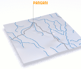 Places with similar names to Pangani, Gabon ::
Disclaimer :: Information on this page comes without warranty of any kind |
||
|
Where is Pangani? Elevation and coordinates ::
Latitude (lat): 1°12'0"S Longitude (lon): 12°28'0"E
Elevation (approx.): 347m (map arrows pan, magnifying glasses zoom) |
||
|
Visiting Pangani? Hotel/Accommodation ::
Book a hotel in Pangani Travel Guide ::
Buy a travel guide for Gabon rental cars ::
car rental offers GPS waypoint ::
download a GPX waypoint (PoI) of Pangani for your GPS receiver
|
||