|
search place name
|
||
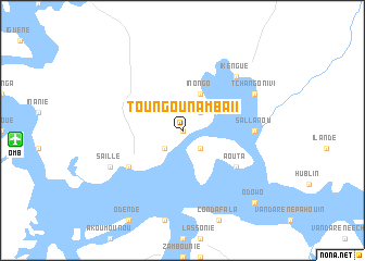
Toungounamba II (Ogooué-Maritime, Gabon)Toungounamba II is a town in the Ogooué-Maritime region of Gabon. An overview map of the region around Toungounamba II is displayed below.
regional and 3d topo map of Toungounamba II, Gabon ::
Toungounamba II airports ::
The nearest airport is OMB - Omboue Hospial Omboue Hopital, located 17.2 km west of Toungounamba II.
Other airports nearby include POG - Port Gentil (119.9 km north west), LBQ - Lambarene (132.7 km north east), Nearby towns ::
Toungounamba I (0.0km north) //
Ambroise (2.6km south east) //
Iréva (2.6km north east) //
Ndjolé (2.6km south west) //
Olango (4.1km north east) //
Inongo (4.1km north east) //
Aouta (6.7km south east) //
Atongoouania (6.7km south west) //
Sallanou (7.4km east) //
Ikengué (7.9km north east) //
Asseve (8.3km north east) //
Tchangonivi (8.3km north east) //
Saille (8.3km south west) //
Odowo (10.5km south east) //
[all distances 'as the bird flies' and approximate] 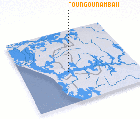 Places with similar names to Toungounamba II, Gabon ::
// Taungnimaw (MM)
// Dongo-Niama (CG)
// Toungounamba I (GA)
// Dan Kunama (NG)
// Tanganama (NG)
// Tunga Nama (NG)
// Tunga Nama (NG)
// Tungan Noma (NG)
// Tungan Numa (NG)
// Tungan Numa (NG)
Disclaimer :: Information on this page comes without warranty of any kind |
||
|
Where is Toungounamba II? Elevation and coordinates ::
Latitude (lat): 1°34'0"S Longitude (lon): 9°25'0"E
Elevation (approx.): 26m (map arrows pan, magnifying glasses zoom) |
||
|
Visiting Toungounamba II? Hotel/Accommodation ::
Book a hotel in Toungounamba II Travel Guide ::
Buy a travel guide for Gabon rental cars ::
car rental offers GPS waypoint ::
download a GPX waypoint (PoI) of Toungounamba II for your GPS receiver
|
||